CO3D
An optical satellite constellation to map the world in 3D

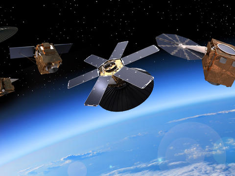
CO3D constellation
The four CO3D satellites are the latest generation of compact satellites that will map the globe in 3D from low Earth orbit from 2025. They will meet the needs of both the public and private sectors. Weighing around 300kg, the CO3D satellites will join Airbus’ fleet of optical and radar satellites, strengthening the company’s ability to meet the growing needs of very demanding applications. Inaugurating a generation of highly innovative and all electric platforms, these extremely agile satellites will instigate the way images are acquired, processed and transferred to the ground.
Together with the four Pléiades Neo satellites, the CO3D constellation will offer unrivalled refresh rates for very high-resolution imagery.
CNES and Airbus have established a virtuous partnership for this project. An integrated and agile governance between both partners will enable the mission to be optimised to cover both private and public needs. The data collected by the CO3D constellation will be available for the scientific and defence institutional partners of the programme.


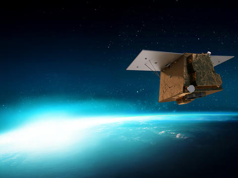
CO3D Artist view
CO3D key features and performances
4 satellites
100% electrical propulsion system
50 cm resolution
300 kg mass
<3 years worldwide digital surface model coverage
The project in brief
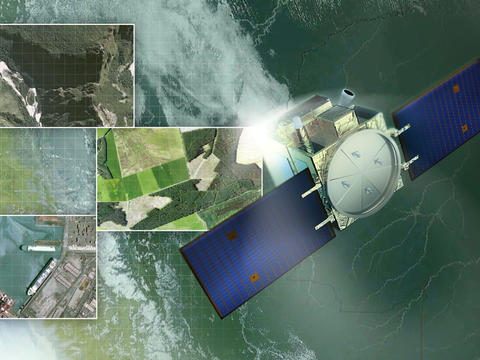
Each CO3D satellite will be equipped with a unique optical instrument, with a spatial resolution of 50 cm in the visible red, green, blue and near infrared bands. After specific ground processing of the results, they will provide 3D maps of all the land areas of the globe, called digital surface models (DSMs) with an altimetric resolution of around one metre.
The DSM produced will represent approximately 25 million km² per year, a rate of accuracy that is unique in the world. They will be used by defence and civil society but should also open up new perspectives for start-ups or established companies that use them for commercial purposes. The entire globe should be covered within 5 years, and depending on the needs of certain specific users (glaciologists, snow scientists, geologists, etc.) certain areas will be remodeled every few months.
Video gallery
-
 CO3D & Pléiades Neo for Defense
CO3D & Pléiades Neo for Defense
Discover how the CO3D and Pléiades Neo satellites provide critical support for military needs. From continuous, all-weather surveillance to ultra-high-resolution object identification, learn how these advanced capabilities enhance strategic autonomy and contribute to a safer world.
-
 CO3D Earth Observation satellite Video
CO3D Earth Observation satellite Video
First CO3D Earth Observation satellite fully integrated in Airbus' cleanroom
The latest earth observation news
in the spotlight
-

A sovereign space intelligence team: Airbus, Rohde & Schwarz, constellr, Orbint, HPS
Press Release
Space
Airbus will collaborate with Rohde & Schwarz, constellr, Orbint and HPS on a satellite-based Earth observation and ISR solution -

Airbus and Hisdesat sign a commercialisation agreement for PAZ-2 satellite imagery
Press Release
Space
-

Airbus fosters Barry Callebaut`s efforts to develop a deforestation-free supply chain
Press Release
Sustainability
-

Successful launch of Airbus-built Sentinel-6B climate satellite
Press Release
Space
-

Airbus-built CO3D constellation successfully launched to map our planet in 3D
Press Release
Space


Discover more about earth observation systems
-
Earth observation systems
Discover our Earth Observation optical and radar portfolio with its comprehensive range of satellite systems to monitor the…
-
CO3D
CO3D, a CNES and Airbus optical constellation to map the world in 3D.
-
PéruSAT
PerúSAT-1 is a very-high-resolution Earth observation satellite system built for the government and Space Agency of Peru.


