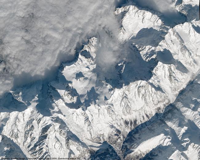
Glaciers, immense reservoirs of fresh water that are essential for the water cycle and life on Earth, seem timeless. Yet they are under threat. Climate change and rising temperatures are causing glaciers to melt at an alarming rate. Using a combination of satellite imagery and field studies, scientists are warning of the consequences for the planet.
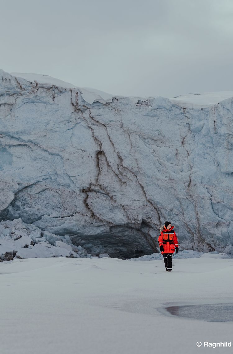
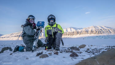
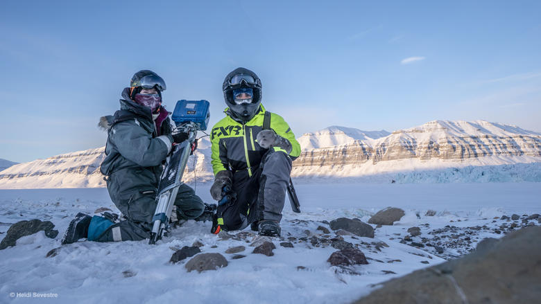
Heïdi Sevestre, a glaciologist, spends half the year in Longyearbyen, the northernmost town on Norway’s Svalbard archipelago, which has become the fastest warming place on Earth, recording a rise in the average temperature of eight degrees since the 1980s. “Svalbard has become a laboratory for studying climate change, allowing us to observe its consequences on glaciers, but also on fauna, flora and its inhabitants,” Sevestre explains.
The importance of glaciers
Formed from snow that has accumulated on land over centuries, glaciers store around 70% of the planet's fresh water and feed several terrestrial ecosystems. They are a source of drinking water for hundreds of millions of people around the world for part of the year. “These natural water towers also fill our rivers and enable crop irrigation, hydroelectric power generation, river navigation and even the cooling of nuclear power plants,” Sevestre continues.
In addition, with their high albedo, or reflectivity, glaciers have a regulating effect on the climate as they reflect the sun's rays back into space, thereby reducing the absorption of solar energy on the Earth's surface. “‘Glaciers are a kind of air conditioner that help keep temperatures down,” explains Sevestre. They also hold the memory of our climate. In Greenland, ice cores have made it possible to trace significant climate change over thousands of years.
Whether in Svalbard, the Himalayas, the Andes or Europe, glacier melt has global repercussions.
Contribution to sea level rise
A study of glaciers published in 2025 in the journal Nature took the scientific community by surprise. Based in particular on satellite data, some of which was developed by Airbus, including TanDEM-X, GRACE and CryoSat, the study revealed that since 2000, the Earth’s 275,000 mountain glaciers have contributed more to rising sea levels than Greenland and Antarctica. “This shows that, among the elements of the cryosphere - frozen parts of the Earth - mountain glaciers are among those that react the quickest to climate change,” explains Sevestre.
Today, ice is the largest contributor to rising sea levels around the world, with thermal expansion linked to ocean warming. Between 2000 and 2023, mountain glaciers lost 6,542 billion tonnes of ice, contributing to a 18mm rise in global sea levels. This melting of glaciers and polar ice caps also disrupts ocean currents, affecting wildlife and local climates.
Increased risks of natural and human disasters
Glacier melt and permafrost thaw increase the risk of natural disasters. Mountain destabilisation, landslides and water pockets draining away threaten surrounding communities.
Thanks to satellite imagery and ground sensors, scientists can launch early warning systems to prevent human disasters.
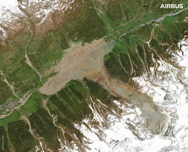
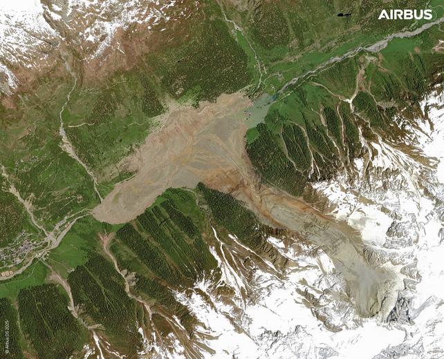
The partial collapse of the Birch Glacier in Switzerland buried the village of Blatten under nine million tonnes of rock, mud and ice in May 2025
Caption: The partial collapse of the Birch Glacier in Switzerland buried the village of Blatten under nine million tonnes of rock, mud and ice in May 2025. Airbus Pléiades Neo HD15 image.
Mountain glaciers also have cultural significance. “In Uganda, for example, they are considered the home of the gods by certain populations. I'll let you imagine what it means to them to see their glacier disappear,” explains Sevestre.
The impact of climate change
As a scientist working with the Arctic Monitoring and Assessment Programme, a working group of the Arctic Council, Heïdi Sevestre regularly participates in climate change awareness campaigns aimed at the general public and governments. "I regularly encounter misconceptions. For example, I still hear people say that Arctic sea ice is growing, when in fact it has lost about 50% of its area and three-quarters of its volume in 40 years," she explains.
The rapid acceleration of glacier melt in recent decades is not a natural phenomenon, but the result of human activity that is warming the Earth's surface. The ice is melting earlier and earlier in the year and is finding it increasingly difficult to reform in winter.
Over the past two decades, glaciers have lost around 5% of their total volume, or an average of 273 billion tonnes of ice per year, which is equivalent to the daily consumption of every person on Earth for 30 years (based on three litres per day).
Satellites: an indispensable ally for scientific research
Studying glaciers involves a number of challenges, such as access, danger and, of course, the cold. Scientists study several hundred glaciers in the field each year, measuring their thickness, speed of movement and biomass.
“Satellites have revolutionised glaciology,” explains Sevestre. They provide additional data with a global or regional view, even in remote and inaccessible areas. The regularity of data over several years makes it possible to measure changes, analyse the reaction of glaciers and develop prediction models.
Satellites not only map glaciers’ footprint, they are also capable of measuring changes in ice thickness and volume, such as the altimeter-equipped CryoSat-2. Stereoscopic imaging enables the creation of digital elevation models of a glacier's surface. Synthetic aperture radar (SAR) such as the Airbus-built Sentinel-1 and TerraSAR-X are very effective for measuring glacier movements and flow velocities.
The multispectral imager (MSI) on the Sentinel-2 satellite, developed by Airbus, can track snow distribution and melting rates, providing insight into snow dynamics over time.
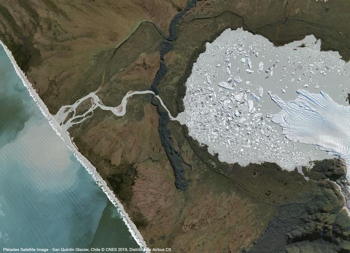
The partial collapse of the Birch Glacier in Switzerland buried the village of Blatten under nine million tonnes of rock, mud and ice in May 2025
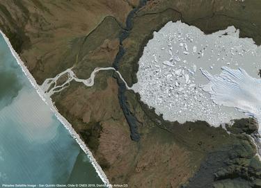
Caption: This image, acquired by the Airbus Pléiades satellite, shows the San Quintin Glacier in Chile. Until 1991, it advanced over the surrounding vegetation-covered land, and its melting has formed a lake at its end. More Airbus satellites imagery here
Satellites: An ally for scientists’ safety
“Glaciers are a bit like a diverse family,” Sevestre says. “There are small ones, large ones, some that react quickly and others more slowly. For field studies, we choose glaciers that are relatively easy to access and, if possible, not dangerous. Satellites are an extraordinary ally for studying glaciers where we would never set foot, or at least not without prior information".
“Matthieu Tordeur and I worked with the Airbus teams, who provided us with satellite images that were essential for preparing our expedition and finding our way around. The very high-resolution images enabled us to map crevasses, helping us to stay out of danger.”
Snowkiting across Greenland
Dr. Heidi Sevestre, glaciologist, and Matthieu Tordeur, polar explorer, led a kite-ski expedition from the south to the north of Greenland.
In some regions, glaciers are retreating so rapidly that they could disappear within a few decades. “But it's not too late to act,” Sevestre concludes.
Closely monitoring glacier parameters is essential, and satellites play a key role in detecting early warning signs. Copernicus missions currently under development, such as CRISTAL for the Arctic and ROSE-L, as well as the CO3D constellation with its 3D model of land areas, will continue to provide scientists with data and inform policymakers on how to preserve these natural wonders that are essential to life on Earth.
