Paris, 25 October 2018 – Airbus Defence and Space has launched Ocean Finder, a selfordering
service delivering fast satellite-based detection and identification reports for assets
at sea. Ocean Finder supports a wide range of applications, such as monitoring fleets of
ships, locating hijacked boats, illegal activities detection, maritime mission preparation as
well as ensuring safety in hostile areas and supporting search and rescue operations.
Ocean Finder leverages the Airbus satellite constellations, offering a full spectrum of Earthimaging
data, spanning multiple resolutions and spectral wavelengths, along with in-house
maritime expertise. The service combines freshly acquired imagery with additional
information sources including AIS (Automatic Identification System) and open source data to
deliver object-centric (ships, icebergs, oil slick) or area-centric (objects in a given area)
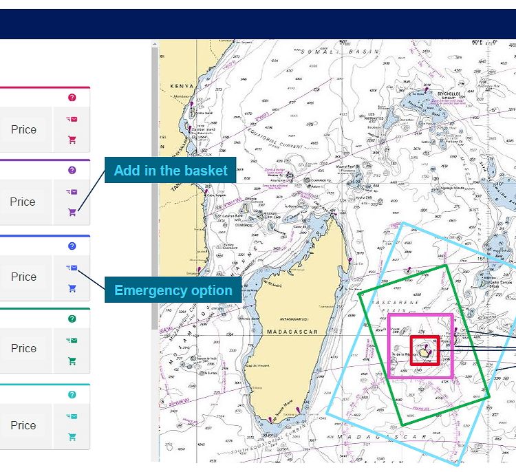
detection and identification. The service is accessed via a dedicated web portal allowing
users to easily define the localisation and the surface of their area of interest and task the
satellites directly. This can be activated in standard mode to support planned mission
preparation, or emergency mode to support urgent intervention.
Find out more here:
https://www.intelligence-airbusds.com/en/8231-maritime-monitoring-services#vessel
***
About Airbus
Airbus is a global leader in aeronautics, space and related services. In 2017 it generated revenues of € 59 billion
restated for IFRS 15 and employed a workforce of around 129,000. Airbus offers the most comprehensive range
of passenger airliners from 100 to more than 600 seats. Airbus is also a European leader providing tanker,
combat, transport and mission aircraft, as well as one of the world’s leading space companies. In helicopters,
Airbus provides the most efficient civil and military rotorcraft solutions worldwide.
Your media contacts
Contact us
Fabienne Grazzini
Communications - Airbus Defence and Space

