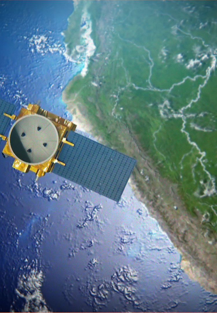
PerúSAT-1 has delivered more than 71,000 images for more than 80 organisations
Lima, 07/12/2017 – PerúSAT-1 has completed its first year of operation and the Peruvian government has recently declared that in that time, the investment it has made into the satellite programme has already been recouped. The Earth observation satellite, built by Airbus in a record time of only two years, has acquired more than 71,000 images which have been delivered to more than 80 organisations across Peru. Peruvian specialists from the National Satellite Image Operation Centre (CNOIS) located in Pucusana, near Lima, have been in control of the satellite since handover from Airbus on December 7th, 2016. PerúSAT-1 is the most advanced satellite in the region.
The Earth observation satellite system PerúSAT-1 provides very high resolution imagery for multiple applications, including security and defence, agriculture, mining, illegal deforestation, risk prevention, mapping, urban planning, land use, ecological economy zoning, countering drug trafficking, among others. The satellite system includes a next-generation satellite, with optical sub-metric resolution of 70 centimetres and a design lifetime of 10 years. It also includes the construction of the CNOIS as the Satellite Control Centre and the processing and management of the images acquired. In addition the system encompassed a technology transfer programme and preparation comprehensive training for the team that operates the satellite today.
PerúSAT-1 embeds technologies that combine readiness and performance; it has been designed to carry out diverse Earth observation missions for monitoring and better managing the environment. All these technologies are employed to serve the needs of Peru. Thus the satellite system provides Peru with a sovereign capacity and plays a key role in providing the benefits of space to its citizens.
Peru’s Space Agency (CONIDA) has been collaborating and working in coordination with many state institutions that receive the satellite images and developed products that benefit people’s everyday lives. Current activities include:
- General Attorney’s office: detection of irregularities in public works
- Peru’s National Police: drug trafficking intelligence and property identification
- Vitor District Municipality: evaluation and analysis of frequent landslides in the Vitor basin
- San Martín Region: map generation to track deforestation
- National Institute for Civil Defence (INDECI): strategic collaboration in response to natural disasters through products and images of affected zones
- National Geographical Institute (IGN): generation of the national cartography, scale 1:25,000, reducing the project’s cost
- Geology, Mining and Metallurgic Institute (INGEMMET): landslides and volcano monitoring
- National Superintendence of State Assets (SBN): strategic collaboration for the monitoring and protection of national assets
- United Nation’s Development Programme (UNPD): elaboration of a database of satellite imagery, aerial reconnaissance and field data for a post disaster evaluation in Lima and Callao after earthquakes
- Mountain and jungle exploration: strategic support for product elaboration in precision agriculture
- San Marcos Mayor National University (UNMSM): generation of a spectral signature data base
- CEVAN, PNP, OEFA: capacity development in the use and processing of satellite imagery
The PerúSAT-1 satellite, built by Airbus, is the first of its kind to be delivered in a record time. It took less than two years from commissioning to delivery. Based on the AstroBus-S platform used in the new generation of high performance satellites, it is designed for a lifetime of 10 years.
PerúSAT-1 in numbers:
70 cm Resolution
10 years lifetime
Only 2 years to build, a record
71,000 images in the first year of operation
15 million km2 of the Earth surface already imaged
14 months in orbit, more than 6,300 revolutions around the planet
Imagery used by more than 80 Peruvian organisations for more than 20 different applications
***
About Airbus
Airbus is a global leader in aeronautics, space and related services. In 2016, it generated revenues of € 67 billion and employed a workforce of around 134,000. Airbus offers the most comprehensive range of passenger airliners from 100 to more than 600 seats and business aviation products. Airbus is also a European leader providing tanker, combat, transport and mission aircraft, as well as one of the world’s leading space companies. In helicopters, Airbus provides the most efficient civil and military rotorcraft solutions worldwide.
Your media contacts
Contact us
Ralph Heinrich
AIRBUS | Defence and Space
Francisco Lechón
External Communications - Airbus Space Systems, Spain
Jeremy Close
AIRBUS | Defence and Space
Guilhem Boltz
AIRBUS | Defence and Space


