The ‘International Charter Space and Major Disasters’ is a unique and worldwide collaboration, through which satellite data are made available to support crisis management. By combining Earth observation assets from different space agencies, the Charter enables resources and expertise to be coordinated for rapid response to major disaster situations; thereby helping civil protection authorities and the international humanitarian community.
Following the UNISPACE III conference held in Vienna, Austria in July 1999, the European and French space agencies (ESA and CNES) initiated the International Charter ‘Space and Major Disasters’, with the Canadian Space Agency (CSA) signing the Charter on 20 October 2000 and was first activated 20 years ago this month. Their assets then were ERS, SPOT, Formosat and RADARSAT. Today, the Charter gathers 17 worldwide members – most of which are space agencies – and 61 contributing satellites.
Airbus and the Charter
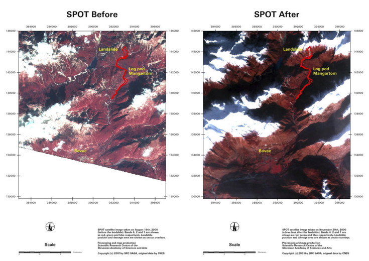
From the very beginning, Airbus satellites have played an active role in the Charter as we took part in the first Charter activation, after a huge landslide occurred in Slovenia in November 2000.
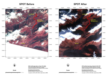
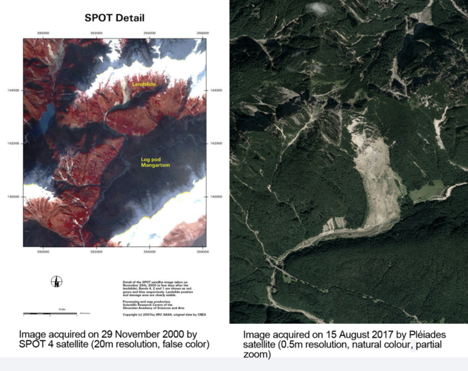
On 27 November 2000, the Civil Protection of Slovenia requested images from the Charter to aid in monitoring and stabilising the landslide, as well as in assessing damage. To this end, we provided two SPOT 4 images: one archive image, taken on 19 August, and a second new image acquired on 29 November, following emergency tasking of the satellite.
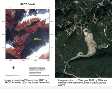
Having an image acquired rapidly at that time was really challenging as there were fewer Earth observation satellites in orbit, meaning that it could take several days before image acquisition. Moreover, the resolution was very different to that of today, making damage mapping much more difficult, as you can understand with the below image comparison showing the 20-year-old image on the left and a much more recent image on the right showing the landslide site, still visible today, in much clearer detail.
In 2005, the UK Space Agency joined the Charter adding resources from the Airbus-operated DMC Constellation. Then in 2010, the German Space Agency (DLR) also became a member of the Charter, providing support through the TerraSAR-X and TanDEM-X satellites, built and operated by Airbus.
What matters most in imagery used to support disaster relief is fast response, but also quality e.g. in cloudy regions a clear view cannot be guaranteed. This is why having a large range of satellites covering the affected area – whether from the Airbus Earth observation constellation or other Charter partners – together with latest-generation sensors, like the upcoming Airbus Pléiades Neo and CO3D satellites, are what makes the Charter so invaluable.
The latest Charter activation supported by our satellites occurred in mid-October, where tropical storms in Vietnam brought heavy rainfall and high wind speeds causing severe flooding across the country’s central provinces, causing loss of life and displaced persons. The main sources of imagery came from TanDEM-X and Copernicus Sentinel-1 satellites.
A team focused on rapid response
The arrival of the Charter reshaped the ways of working for the Airbus team in charge of satellite tasking. They moved from normal working-hours to a real 24/7 set-up to make sure they were ready and available to support requests from the Charter.
How do Airbus’ teams manage Charter activation requests?
When the 24/7 team receives a request, they rapidly analyse the upcoming satellite passes to propose a tasking plan. This means selecting the right satellites and conducting an acquisition feasibility study (taking into account elements like location and weather). The selected satellite is then tasked, for the next 10 days, and the activation stops as soon as the expected image is acquired: cloud-free, full coverage of the target area). Once the satellite images are acquired, they are sent to the requesting authority and enter the processing chain to map the affected areas.
Irrespective of the origin of the request, the process remains the same, with a dedicated, highly professional and responsive team, where everything possible is done to shorten the time between Charter activation and map delivery to the rescue teams on the ground.
More information:
Airbus satellite tasking: https://www.intelligence-airbusds.com/one-tasking/
Airbus satellite imagery: https://www.intelligence-airbusds.com/optical-and-radar-data/
