T
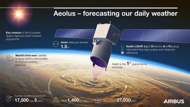
hree years ago saw the launch of Europe’s Aeolus wind measuring test satellite to trial the first ever Doppler Wind lidar – a laser radar – in space. It has proven so effective that its measurements are now used in daily forecasting – no mean feat given this was never part of the mission plan.
So what was the plan? To test the use of satellite-borne lidar technology – enabling permanent measurement from much higher altitudes than balloon-borne instruments – for global wind-profiling around the globe. This data is vital for meteorologists and climatologists to improve weather forecasts and better understand the dynamics of Earth’s atmosphere and climate variations. Accurate wind forecasts are also crucial for activities such as farming, fishing, construction and air transport.
A rocky start
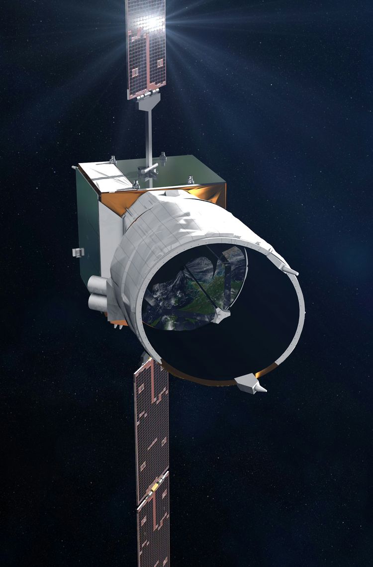
However, breaking new ground in space technology is never easy and Aeolus was no exception. Development of the highly complex lidar instrument for this European Space Agency (ESA) mission was particularly challenging – an example being the strength of the laser within the lidar which, when a prototype was first tested, proved so strong that it was destroying the laser’s optics at a rate of 50% in under six hours. At the time this was a huge set-back for the team but ultimately solving the problem created new technology that will support a number of future missions.

The moment of truth
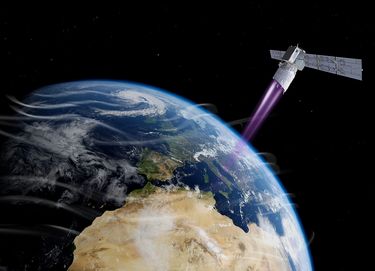
On 22 August 2018, ESA’s Aeolus satellite was launched and within a week came the moment our engineers had all been waiting for: switching on of the lidar instrument and its first emission of ultraviolet pulses. It is these pulses which enable Aeolus to take a 0km-25km slice of the atmosphere and, using a laser and Doppler Effect, make an accurate wind-map at all latitudes with a 250m resolution. The first results didn’t disappoint.
From super-powered to sub-powered
In the first several months of operations, Aeolus continued to demonstrate its lidar was up to the job, but then signs of energy loss were observed on the laser transmitter, threatening to compromise data quality. But, being a test satellite, a back-up laser had been built in to the design and the Airbus and ESA teams worked together to make a successful switch over to the second laser. Far from being seen as a failure, the first laser nevertheless notched up almost one billion shots and provided a vital first dataset of its kind.

From strength to strength
Since then, Aeolus has consistently delivered high quality data and has gone above and beyond its original mission. From stepping in to provide missing wind measurements that used to be taken by planes before covid, to its data being deemed so valuable that it has been adopted for daily weather forecasting. Indeed, the volume of data also clearly sets it apart, since this one satellite is delivering more wind data than all existing ground-based measuring systems. And after three years in orbit Aeolus has now exceeded its design lifetime and is still going strong.
Philippe Pham, Airbus’ Head of Earth Observation & Science concludes: “That Aeolus data is now being used as part of the operational weather forecasting flow demonstrates its quality and reliability. Built as a one-off research mission, Aeolus is truly exceeding all expectations – testament to our engineers’ skill and determination in developing this new technology. Its success also paves the way for a possible future fleet of Doppler wind Lidar satellites in space.”
Not bad for a test satellite.

