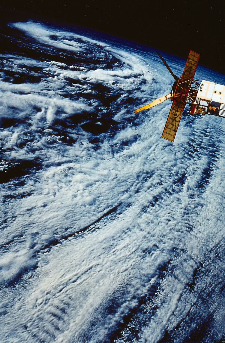
On July 17, 1991, the first European polar-orbiting Earth observation satellite, ERS-1, built by what is now the Airbus space division, was launched into space. ERS-1 (1991-2000) and the nearly identical ERS-2 (1995-2011), also built by Airbus, laid the foundation for what is now Europe's world-leading Earth observation system.
Three questions for: Prof. Dr. Volker Liebig
Volker Liebig was Director of Earth Observation at the European Space Agency (ESA) from 2004 to 2016. Since 2010, he has also been an honorary professor at the University of Stuttgart's Institute of Space Systems (IRM), lecturing on satellite programs for Earth exploration and telecommunications. Liebig also serves as Senior Advisor for Digital Satellite Services for Airbus.
Thirty years ago - on July 17, 1991 - the first European Earth observation satellite, ERS-1, was launched. What was the significance of the ERS program for the development of successful Earth observation in Europe and for the development of the space industry in Europe?
ERS was really the launch pad for European Earth observation. The satellite was developed primarily for ocean observation, but quickly became the "workhorse" for many Earth science studies. In particular, the new methods of radar interferometry, which can measure digital terrain models and the speed of movement of glaciers and ground motion caused by earthquakes, have revolutionized the Earth sciences.
Another large Earth observation (EO) satellite followed, Envisat and then Europe’s EO program broadened out. In 1998, the EU and ESA initiated the Copernicus program, comprising a fleet of new Earth observers, the Sentinels (currently eight in orbit), and provided a push on the user side by making the data available free of charge. The satellites of the so-called Earth Explorer series continue to address scientific questions. What contribution does the EO program make to Europe - technologically, ecologically and economically?
After Envisat, a satellite the size of a small bus, we at ESA wanted to switch to smaller satellites and launch a mission every 1-2 years. The technology was also ripe for smaller satellites. Then the definition and implementation of the Copernicus program was really the game changer for operationalizing Earth observation in Europe. Again, we went for smaller satellites. Sentinel-1 and 3, for example, now have modern versions of the instruments of the ERS satellites, that is, radars and altimeters. This made Europe independent for the first time in environmental data. At the same time, there was a huge push on the analysis side as the data became freely available to all. Thousands of data analysts started to use the EO data for their AI applications. In the meantime, there are hundreds of thousands of users and practitioners from all application areas - from determining sea level rise to international fire systems, from tracking oil spills on European waters to emergency services during crises. In addition, many commercial applications have emerged and are being used more and more, e.g. for monitoring infrastructures such as dams or bridges for movement, to name just one. Of course, the Copernicus system and Earth Explorer series also mean an ever-expanding very innovative market for the space industry. All this has led to European industry being a leader in Earth observation worldwide, which is not the case for many other fields.
The amount of data and measurements of the planet collected by satellites has steadily increased, with the results becoming more and more accurate, more and more small-scale, and available more and more quickly. What does that leave for "Earth observation of the future?" Let's say - in the next 30 years?
The Earth system is very complex and hardly any Earth science today can do without satellite data. The best-known fields are certainly climate research and oceanography. Without new missions, our ambitious climate goals will not be feasible. To do this, we must constantly monitor the state of our environment and try to understand the complicated processes so that we can take corrective action if something is going in the wrong direction or is insufficient. Increasingly, however, businesses are also demanding more information, e.g. to prove the environmental and social compliance of their supply chains, e.g. by monitoring that no rainforest is cleared for the cultivation of their own products.
So we can expect many new satellites and services in the next 30 years. What we already see on engineers' drawing boards are missions to study plants via fluorescence, to tomograph rainforests with long wavelengths, to study the interaction of solar radiation, aerosols and clouds, to identify major CO2 emitters directly from Earth orbit, and much more. Of course we need to record the most important environmental parameters over many decades, things like sea level rise (currently already at over 3 mm per year), the melting of sea ice and the large ice masses at the poles or the observation of permafrost areas. I hope that in 30 years we will have already made progress and that we will see the first successes of the new climate policies, just as we see today that the ozone hole is slowly closing again after the policy makers reacted correctly on the basis of scientific data. Prof. Crutzen, who was awarded the Nobel Prize for his research on ozone chemistry, was also one of the intellectual fathers of GOME on ERS-2 and later of Sciamachy on Envisat. This is a nice link back to the ERS-1 launch 30 years ago.
