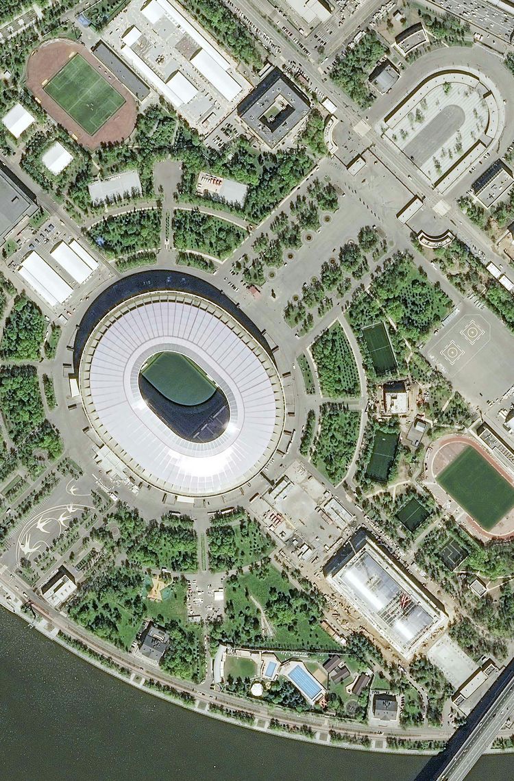
Even before final calibration, the images provide an impressive level of detail. From counting each and every limestone brick on the Egyptian Pyramids, or even the number of people visiting them, to admiring the multi-layered construction of Castel Sant’Angelo across the years, Pléiades Neo reveals it all. Urban areas and modern architectures are not to be outdone, as their sheer diversity is faithfully reproduced in the images over Shanghai, Dubai and Washington DC.
In the beginning…
The Pléiades Neo satellite project was born a few years ago when Airbus decided it was time to take a strategic turn. The Earth observation market was quickly changing and new competitors were emerging on the same segment. Airbus has always been at the forefront of this very dynamic market but it saw that staying a leader would take more than just doing what everyone else was doing. It needed to take the plunge and invest in break-through technologies that would set it apart.
The challenge: deliver the freshest and highest precision satellite imagery available in the world today and make it readily available to all.
The solution: Airbus took the initiative to invest in developing a constellation of four high performance satellites, tailored to today’s market. This was a real break with the past where Airbus had only built such satellites for government customers. It was so convinced by the need that it decided to finance, build, launch and, of course, operate the satellites.
High performance satellites
On the satellites, the result is the best of both worlds, with optimal size and state-of-the-art imagery. Equipped with a light weight, latest generation silicon carbide optical instrument, Pléiades Neo delivers imagery at 30 cm native resolution, a clear leap forward compared to the previous generation.
Each highly agile satellite will capture up to half a million km² per day of imagery – this represents/is equal/is equivalent to/ the surface of Spain–providing customers with very high-precision insights over the next decade and beyond. The satellites also have inter-satellite links with SpaceDataHighway (EDRS) satellites to enable images to be downloaded in near real time after acquisition. When the need is urgent, acquisitions can be made in just a few minutes following the tasking request, to swiftly respond to the most critical situations.
Getting the images back fast
As with any space system, it’s not just about what’s in space, but also what’s on the ground. And the Airbus ground system has what it takes: multi-mission, large-scale on the fly real time image processing and above all, easy data access from tasking to product delivery. We have developed high-powered big data and cloud technologies that make all the difference – not only enhancing applications in traditional fields but opening up many new applications in analytics, intelligence and developing markets.
Wider benefits
Game changer is a word we hear all too often, but it’s not an exaggeration for Pléiades Neo. Not just in terms of the imagery market, but also because this heralds the arrival of a completely new generation of satellites, systems, services and business models. The lessons Airbus has learnt while developing this state of the art constellation, further refining the silicon carbide technology and optical instrument design that it first pioneered 20 years ago, will enable it to provide even better solutions in all resolutions.
With the first Pléiades Neo now in orbit, joining the world’s largest optical and radar satellite fleet – Airbus is already looking to the future generation of Earth observation satellites. Infrared is the next frontier and our engineers are already working hard on two climate missions. Airbus is ready for the challenge!
Your media contacts
Contact us
