Summary
- In spring 2014, the Peruvian Space Agency CONIDA selected Airbus as the prime contractor for the PerúSAT-1 Earth observation satellite programme. This included an in-orbit delivery of its first satellite, PerúSAT-1, as well as the corresponding ground control segment, an image reception and processing center, an extensive training on satellite operations and data exploitation as well as a privileged access to Airbus’ own Earth observation satellite constellation since day one of the contract.
This commitment to Space puts Peru in a privileged position to expertly exploit both their own satellite and other Space assets, also in difficult times.
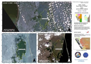
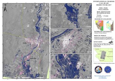
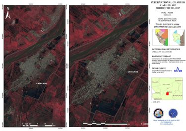
According to the “International Charter Space and Major Disasters’s” website, the Charter was activated on March 31, 2017, as Peru was undergoing devastating floods, which forecasts suggest could continue until May. According to the same source, the flooding is the result of a local El Niño weather system which has brought torrential rain to northern Peru since early March. The cities of Piura, Trujillo and Chiclayo are among those worst affected, but estimates suggest that 800 villages have also been destroyed. The floods have caused mudflows to sweep into some cities, bringing further disruption.
CONIDA is project managing this Charter call in its entirety and, starting the day after the Charter activation, a variety of satellites such as the German radar satellite TanDEM-X (a part of the Airbus Constellation) have rapidly provided imagery that was processed into flood maps by CONIDA’s imagery experts. In the effort of creating change detection maps, recent archive imagery from CONIDA’s own PerúSAT-1 (built by Airbus) as well as Airbus’ SPOT 6, proved to be a valuable reference.


The “International Charter Space and Major Disasters” aims at providing a unified system of space data acquisition and delivery to those affected by natural or man-made disasters through Authorized Users. Each agency member has committed resources to support the provisions of the Charter and thus is helping to mitigate the effects of disasters on human life and property.
Read more (and download higher resolution maps) on the Disaster Charter’s Website
About PerúSAT-1
PerúSAT-1 was built for CONIDA by Airbus in a record time of only 24 months. The comprehensive programme not only comprised a top-of-the-class Earth observation satellite, but also the corresponding ground segment, an extensive training on satellite operations and data exploitation as well as complimentary access to Airbus’ own satellite constellation. Read more…
