Earth observation satellites CryoSat-2 and Sentinel-6

An important basis of the COP21 discussions is scientific data collected by satellites like CryosSat-2. Klaus-Peter Köble, head of the Sentinel-6 programme, outlines the role Airbus DS satellites are playing in climate research.
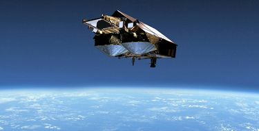
CryoSat-2 orbits 700 kilometres above the Earth and measures changes in the thickness of polar ice using radar waves. Why is this data so precious?
We know that sea levels are rising, and data collected by CryoSat-2 has shown the extent to which melting ice in Greenland and the Antarctic is contributing to this. There are a lot of factors which indicate that climate change is not a seasonal phenomenon. Those who doubt climate change say this is just a temporary effect, that this is something that happened every once in a while in previous centuries. But the changes we are currently observing – also thanks to the data collected by CryoSat-2 – are so dramatic that we can’t dispute that they will have a lasting effect.
CyroSat-2 celebrated five years in space in 2015. What is the feedback from the scientific community – has the satellite performed as expected?
It has exceeded expectations. The satellite has provided knowledge that researchers didn’t expect due to its extreme precision. Deep under the Antarctic ice, for instance, is an entire network of lakes. One of these is as big as 350,000 football fields . How widespread these lakes are and how they change is knowledge we have gained only through CryoSat-2.
Meanwhile, the Sentinel-6 satellites – to be launched in 2020 and 2026 – will measure how the sea level is changing as part of the European Earth Observation Programme Copernicus. This has been done by other satellites before. What can the Sentinel-6 mission do that wasn’t previously possible?
Sentinel-6 ensures the continuation of sea level variation measurements for the next 15 years. With its enhanced instrument technology and new calibration capability the data quality is significantly improved. This is true not only over the oceans, but also in coastal regions for which up to now no relevant data is available. The significance of sea level variation data from coastal region for climate research is undisputed among the scientific community.
Why is that important?
Sentinel-6 will deliver answers to questions such as, how will the sea level change in the years ahead. This is not only important for refinement of the global climate models but also very valuable information especially for development and protection of coastal regions. City planners use the data from Sentinel-6 to plan for protective measures in cities close to the coast, such as Hamburg, New York or Rotterdam. Furthermore, large container ships are regularly surprised by rogue waves. With help from Sentinel-6, we can predict these waves early enough before they become a danger.
Chasing answers with the H125 – A powerful ally
Polar bear hunting
Stretching out beneath the helicopter is a seemingly endless sheet of Arctic ice. Suddenly, a polar bear appears in the whirled up snow.
The helicopter flies towards the animal. Hearing its blades, the bear tries to escape. But the helicopter continues to sink slowly down as the side door slides open.
A passenger appears, aiming a rifle at the bear. A shot cracks above the noise of the rotors. The polar bear is hit but continues to run for a few more seconds before collapsing onto the ice.
But the animal is not dead. It is just unconscious, shot with a tranquiliser rifle so that the scientists on board the helicopter could take blood samples and DNA probes to examine the grade of pollution in the arctic.
Trapped in the cold
The operator of the helicopter is Airlift, which has been performing these data collection flights since 2011. The Norwegian company uses Airbus Helicopters’ H125 (previously named AS350) machines. This operator offers different services for scientific missions in the Arctic and Antarctic, where they fly over ice fields with a torpedo-like device mounted under the helicopter. But here, nothing gets shot. The device is an electromagnetic measuring system that assesses the thickness of the sea ice.
“We also have radars underneath the helicopter to record any changes to the glaciers,” explains Gunnar Svein Nordahl from Airlift. “For instance, we can see if they’ve moved or even sunk somewhat from the year before.” On these missions for the Norwegian Polar Institute, the crew is often stationed in the Antarctic for months at a time – at temperatures as low as -30°C.
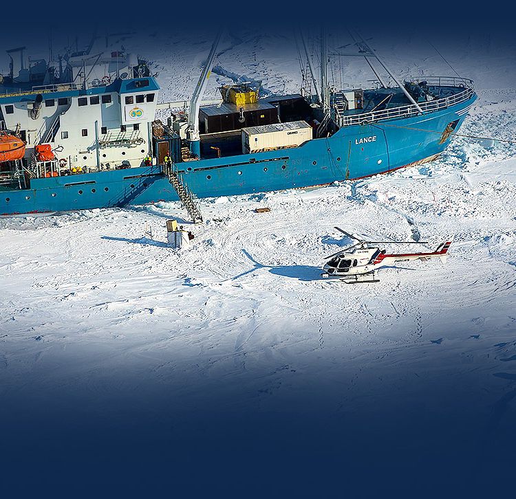
On a mission in 2015, an ice breaker with 30 scientists and the H125 on board was deliberately frozen into the ice of the Antarctic. The mission was to explore, among other things, the drift of ice and the pollution of air, water and ice. Scientists and helicopter crew spent six months on the frozen ship.
“These missions can be very difficult,” says Nordahl. “But it is an important task, because the data we collect enables researchers to observe changes in the climate.”

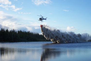
Norway's Pegasus Helicopter is using H125s to sample water from different locations in order to survey the level of acidity in dozens of lakes. Acid rain, caused by sulphur and nitrogen emissions, has plagued Norway and Sweden for decades, damaging their forests and contributing to the loss or depletion of more than 15,000 fish stocks.

Scandinavian helicopter company Kallax Flyg has helped scientists research the climate and water circulation in the wilderness of the Arctic and even Antarctica. A H125 has allowed scientist to carry out advanced sampling and search and identify hundreds of Antarctic seals, part of a research programme to document marine mammal health and migration routes.
In the zone – Measuring atmospheric changes with Airbus

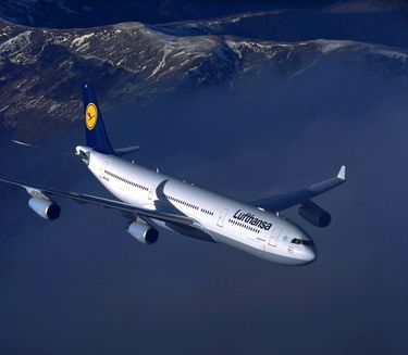
Six Airbus A340-300s and one A330, equipped with measurement devices are flying daily and internationally, with the support of the programme’s associated airlines: Lufthansa, China Airlines, Air France, Iberia, Cathay Pacific and Air Namibia
Airbus and MOZAIC – Genius and simple
It’s exactly 20 years ago that Vincent-Henri Peuch first got in touch with the MOZAIC (Measurement of OZone and water vapour by Airbus in-service Aircraft)/IAGOS programme. The then 25-year-old scientist had just started his first job at the research institute Meteo France in Toulouse.
Meteo France was one of the partners in the MOZAIC climate research programme, whose aim was as genius as it was simple: commercial Airbus aircraft equipped with fully automated measuring instruments fly around the globe, recording trace gases such as nitrogen oxides, ozone and carbon dioxide to collect key data for climate research.
The first measurement was performed on an Air France Airbus A340 flight from Caracas to Bogota in August 1994. The idea proved to be relatively cheap and highly efficient at the same time. “What makes commercial aircraft so suitable for this kind of mission is that they usually fly directly around the tropopause,” explains Peuch. “This is the region of the Earth’s atmosphere situated at around 10km of altitude and is crucial for climate processes and meteorology.”
The atmospheric composition changes are very important because they are the link between the cause – human activity that alters the volume of emissions – and the result, namely changes in our climate.
When facts count
Vincent-Henri Peuch is still benefiting from the MOZAIC/IAGOS data for his job, now as Head of the Copernicus Atmosphere Monitoring Service (which uses the Sentinel satellites) at the European Centre for Medium-Range Weather Forecasts. “This information has significantly improved our understanding of air quality and climate change,” he says.
To date, the measurements captured on more than 41,000 commercial flights have been added to the MOZAIC/IAGOS database with free access given to international scientific and policy-making communities. “There are still discussions about whether or not climate change is really happening,” Peuch says. “Projects such MOZAIC / IAGOS contribute something very valuable to this debate.”
Beata Cece
