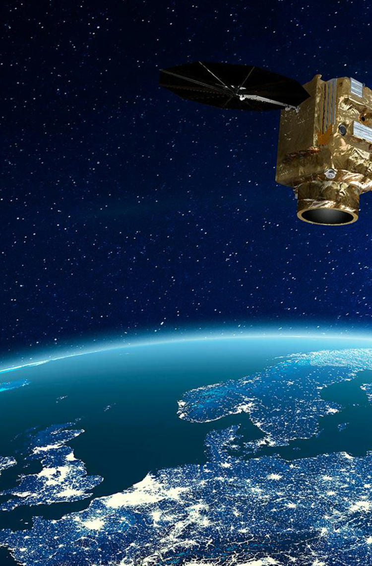
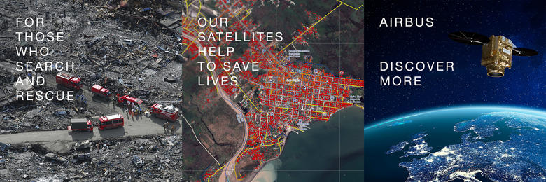
Whenever a disaster strikes, the International Charter Space and Major Disasters activates satellites to direct humanitarian relief to those in need and help rescue teams on the ground. And for the first time, Airbus’ Pléiades Neo has joined the pool of satellites available when the Charter is activated.
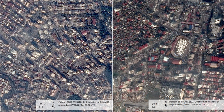
At 4:17 a.m. on 6 February, 2023 an earthquake struck Turkey and Syria. At 7:04 a.m the same morning, EFAD, the Turkish Disaster and Emergency authority, triggered the International Charter Space and Major Disasters. Its activation immediately programmed the most suitable satellites to acquire the data related to the disaster. The following day, the first pictures of the earthquake's consequences were transferred to the Turkish authorities, helping rescue teams on site to make decisions by showing the extent of the damage.
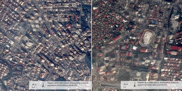
A heavily damaged area of the city of Antakya (formerly Antioch), Hatay province, located in the south of Turkey. © CNES (2023), Distributed by Airbus DS
The International Charter Space and Major Disasters, an invaluable tool to save lives
Whenever a major disaster occurs, satellites play an essential role by providing a global view and accurate data that can only be captured from space. Helping first responders is the purpose of the International Charter “Space and Major Disasters”.
Signed in 2000 by the European Space Agency (ESA) and the French Space Agency (CNES), the Charter combines and coordinates about 270 satellites and the expertise of 17 space agencies. It can be activated free of charge by any country on earth, thanks to universal access*.
As Emilie Bronner, CNES Representative at Executive Secretariat of International Charter Space and Major Disasters, explains, “As soon as we receive a request to activate the Charter, all designated members mobilise their Earth Observation satellites in urgent and priority mode.”
Equipped with the right information, local authorities can make better decisions, including assigning rescue teams’ priorities, assessing damage or identifying the types of aid or relief most needed; as well as observing population displacements.
High-resolution satellite data to map, monitor and mitigate impacts
Natural disasters such as storms, earthquakes, floods or wildfires, can drastically alter landscapes and cut communications. “In some situations, maps are no longer sufficient. Ground infrastructure like roads or bridges may have been destroyed. Rescue teams rely on satellite imagery to act quickly, orient themselves in the field and support coordination,” says Bronner.
The Charter relies on Earth observation satellites which are already operated for other purposes. Depending on the disaster, different types of satellites can be activated in parallel, such as those in the Airbus-built constellation including SPOT, Pléiades, TerraSAR-X and TanDEM-X and, for the first time, Pléiades Neo. The combination of optical and radar satellites provides the fastest response with the highest quality.
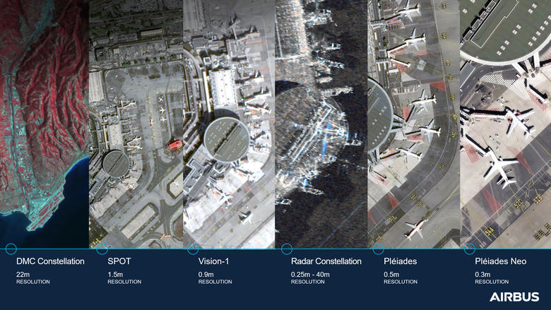
Optical satellites provide high resolution images. With a 30 cm resolution, the Pléiades Neo constellation is perfectly adapted to map in detail the damage to road networks or individual buildings. While radar imagery can penetrate cloud cover and operate at night. Both are key to quick delivery of aid and support. It is also possible to compare archived data with newly acquired data, preparing damage assessment maps which offer further, detailed views of how the landscape and infrastructure have been affected.
“Pléiades Neo’s highly automated management is a perfect match for the Charter’s needs for speed,” says Isabelle Zago-Viou, Head of Satellite Operations and Platforms at Airbus Defence and Space. “The two Pléiades Neo satellites have fifteen tasks requests planned every day, per satellite. We can respond to urgent requests for imagery, programming each satellite up to fifteen minutes before the next plan is uploaded. This enables the satellite to pass over the target area over the subsequent two hours, and with a revisit twice a day. Moreover, we are using artificial intelligence to improve accuracy and transform information into actionable data.”
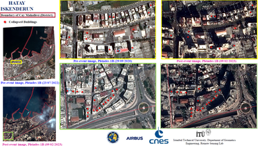
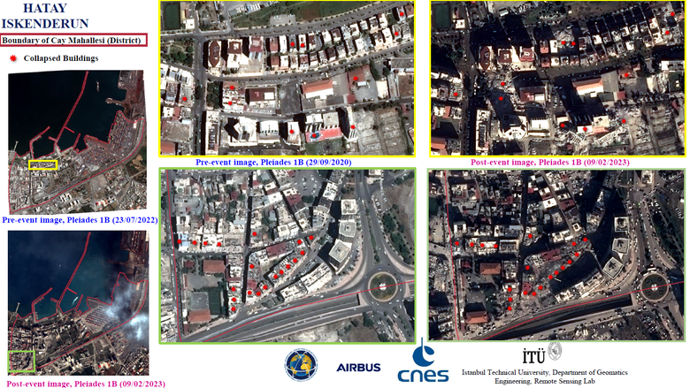
Satellite imagery can then be transformed into damage and situation maps (see example below). To get a picture that is easy to interpret from a satellite image, the Charter uses a rapid mapping service composed of cartography experts able to compare before and after data and identify the changes.
Collapsed buildings in Cay Mahallesi of Iskenderun, Hatay. Turkey. Following the Charter’s activation, more than 350 crisis images from 17 space agencies across the world were delivered. © CNES (2022-2023), Distribution Airbus DS. Includes Pléiades material. Map produced by Istanbul Technical University Department of Geomatics engineering Remote sensing Lab (İTÜ)
“The Charter is a fantastic example of how the international space community can work together to help with disasters,” Bronner concludes. “The intensity and frequency of natural disasters are increasing and are affecting the entire planet, but we are prepared.”
Emilie Bronner, a doctor in topography, began working in the space industry 18 years ago ©CNES - https://disasterscharter.org/web/guest/how-the-charter-works
The Space and Major Disasters international Charter in a nutshell
- The Charter is an international cooperation composed of 17 space agencies
- 131 countries have benefited from the Charter since its creation
- "Natural or technological disaster" definition: a situation of great distress involving loss of human life or large-scale damage to property, caused by a natural phenomenon, such as a cyclone, tornado, earthquake, volcanic eruption, flood or forest fire, or by a technological accident, such as pollution by hydrocarbons, toxic or radioactive substances.
- The principle of *universal access: any national disaster management authority is able to submit requests to the Charter for emergency response.
Video: https://youtu.be/ZvExM-Z3E2w
Examples of maps or High-resolution imagery created after a disaster based on satellite data.
Beirut, Lebanon
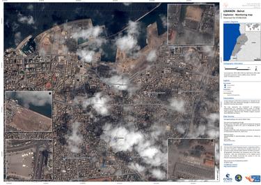
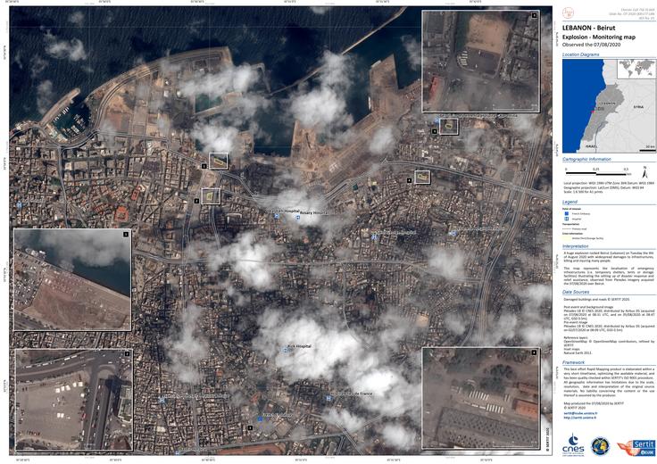
A huge explosion rocked Beirut (Lebanon) on 4th August 2020 with widespread damage to infrastructure, killing and injuring many people.
The map shows the impact of the explosion based on Pléiades imagery from above.
© SERTIT, CNES, Distribution Airbus DS.
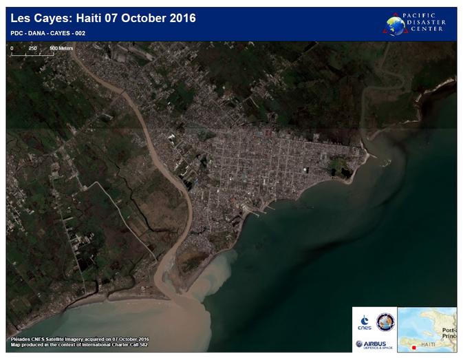
Les Cayes, Haiti
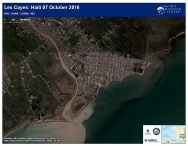
On 4 October 2016 Hurricane Matthew, a Category Four storm, hit Haiti. It brought winds in excess of 230 km/h (145 mph) and heavy rain which caused flooding. Tens of thousands of homes were destroyed, and some villages and towns were entirely destroyed. Thousands of people were left homeless and while many survivors were provided with tents, and relief centres were established, it is estimated that over one million people were affected.
© CNES (2016), Distribution Airbus DS. Map produced by Pacific Disaster Center
Latest News
Continue Reading

Airbus and Hisdesat sign a commercialisation agreement for PAZ-2 satellite imagery
Press Release
Space
Airbus Defence and Space and Hisdesat sign a commercialisation agreement for PAZ-2 radar satellite imagery and applications
The first Airbus Pléiades Neo Next satellite will be launched early 2028
Press Release
Space

Airbus launches demonstrator to test global 5G connectivity in orbit
Press Release
Innovation
Airbus ships fourth European Service Module for Artemis IV
Press Release
Space
Sentinel-1D: the radar that never sleeps
Web Story
Space
