
Smarter firefighting: Airbus unveils Wildfire Sentinel to interconnect the front line

As wildfire seasons grow longer and more extreme, rapid response is vital. Airbus’ Wildfire Sentinel seamlessly connects aerial and ground teams to accelerate fire suppression.
There is a palpable sense of concentration at the Garrigues military camp in southern France, where a unique trial is underway. High above, an Airbus Aliaca uncrewed aerial system (UAS) is transmitting live infrared images directly to a mobile command unit on the ground.
At the same time, Airbus’ Agnet collaboration platform is providing a secure and reliable connection via broadband connectivity. An Airbus H130 Flightlab helicopter hovers nearby, receiving optimised flight paths and exact coordinates on its cockpit display.
This ability to share data in environments where traditional mobile phone service fails is a core component of the Wildfire Sentinel. Rather than operating in isolation, aircraft, helicopters, drones and ground personnel can be connected in real time. The trial highlighted highly accurate water drops executed just minutes after a simulated wildfire ignition. This proves that digital connectivity can drastically reduce the critical time between detecting a spark and delivering the first drop of water.
“Airbus’ ambition is to build an ecosystem that will answer the new challenges of managing wildfires in a more extreme environment ,” says Oliver Chalvet, Senior Manager for Firefighting Solutions at Airbus Defence and Space.

Wildfire ecosystem Infographics 2026
A sophisticated digital bridge
The Wildfire Sentinel, developed by Airbus, is a holistic, data-driven firefighting ecosystem that combines Airbus’ technology bricks (aircraft, communications and flight operations) with solutions from partner companies.
Its core capabilities are seamless data exchange via the collaboration platform Agnet and real-time tactical situation awareness. These capabilities improve coordination between emergency teams, enhance decision-making and protect the safety of aerial firefighting operations. By aggregating optical imagery from light aircraft and UAS with Earth observation satellite data and terrain mapping, the system uses AI-enabled processing to provide a comprehensive tactical picture.
Connecting satellite surveillance directly to a tactical command network allows Wildfire Sentinel to eliminate the ‘information lag’ that can cause small brush fires to grow out of control . This dynamic map automatically takes into account wind speed and direction and the exact positioning of emergency response teams. It transforms raw data into immediate, coordinated aerial strikes, ensuring that the first response is the most effective one.

Airbus brings digital technology to firefighting
[© Airbus Helicopters | & Barbara Da-Silva Eric Raz]
Tested earlier this March in Nîmes, the Wildfire Sentinel trial mobilised the Airbus H130 Flightlab helicopter, an ATR 72 and Cirrus SR20, four drones (including the Airbus Aliaca), and three firetrucks from the Departmental Fire and Rescue Service of Le Gard.
"We connect aerial resources with ground assets using geolocation, observation data, and an integrated database accessible to all stakeholders,” explains Thierry Fol, Head of the Airbus Flightlab. “In this way, the firefighter commander no longer has to rely on fragmented radio calls. Thanks to Agnet they see a real-time, high-definition digital map of every drone, aircraft and ground crew, ensuring total situational awareness even in the most disconnected environments."
The invisible shield against wildfires
In 2025, Earth observation satellite data recorded approximately 390 million hectares of fire-affected land globally. That is roughly 92% of the entire land area of the European Union.

H145 Ecocopter - Firefighting
End-to-end aerial capabilities
While the Wildfire Sentinel acts as an integrated, multi-layered technological framework with an AI-driven digital brain, Airbus also provides the physical muscle required for complex firefighting operations. The trial in Nîmes also showcases the company’s ambition to deliver a fully interoperable fleet to operators around the world.
- Agile Helicopters: From the light, single-engine H125, which can carry four firefighters and drop 1,200 litres of water, to the medium H145 as well as the heavier workhorses such as the H215 and H225, Airbus helicopters can operate in challenging weather conditions. Equipped with flexible buckets or belly tanks, they can drop up to 4,000 litres of water per pass to contain blazes and protect ground crews. Teaming between helicopters and uncrewed aerial assets such as Flexrotor also helps firefighters assess the risk of a fire breaking out in the area and determine exactly where they need to intervene.
- Next-generation amphibious scoopers: In anticipation of future fleet renewals, Airbus is collaborating with the French start-up HYNAERO to develop a new European amphibious water-scooping aircraft. This aircraft aims to double standard operational capacities by carrying ten tonnes of water at speeds of up to 250 knots.
- Heavy tactical aircraft: The A400M military transport aircraft brings heavy-payload capability to the theatre. Its innovative roll-on/roll-off (Ro-Ro) firefighting kit, which is currently in development, requires no permanent modifications. This enables air forces to swiftly transform a standard cargo aircraft into a water bomber, capable of dropping 20,000 litres of water or retardant via gravity.

A400M Firefighter Nimes
Continuously monitoring fires from space
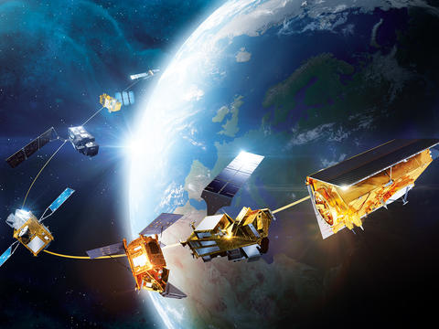
Effective firefighting begins long before the first smoke appears. Using its constellation of Earth observation satellites, Airbus provides vital imagery that serves as an early-warning system. By measuring forest dryness and spotting tiny heat signatures in remote areas, these satellites help authorities identify high-risk areas and prepare their response before a spark ignites.
To manage an active crisis, the Copernicus Emergency Management Service (CEMS), provides information near-real time on forest fires across the globe. This monitoring is made possible by data from satellites including Sentinel-1 and Sentinel 2, for which Airbus designed and built the instruments.
Once the fire is contained, the focus shifts to recovery. Here, very high-resolution images from the Pléiades Neo satellites allow for precise post-crisis damage assessment.
By combining advanced hardware with the digital architecture of the Wildfire Sentinel, Airbus delivers the end-to-end connectivity that modern operators need to protect ecosystems, communities and lives.
Airbus' end-to-end firefighting support
The Wildfire Sentinel trial in Nîmes, France.
-


Wildfire
-


Wildfire
-


Wildfire
-


Wildfire
-


Wildfire
-


Wildfire


Discover more
-

Helicopters
Airbus delivers the most efficient helicopters to customers who serve, protect, save lives and carry passengers in demanding…
-
Earth observation
Airbus provides Earth observation satellite systems and services to help our customers better understand climate change and…
-
Military Aircraft
The company’s military aircraft portfolio includes the Eurofighter combat aircraft; the A400M, C295 and CN235 airlifters; and the…


Latest Defence, Helicopters and Space News
-

Amid the flames
Web Story
Helicopters
Super Puma operators battled Europe's extreme wildfire season, discharging over 122 million litres of water across major blazes in Spain and France. -

Romania orders 12 Airbus H225M multirole military helicopters
Press Release
Helicopters
-

Shaping the future of flight testing
Web Story
Helicopters
-

Airbus delivers first batch of next-generation satellites for Eutelsat’s OneWeb…
Press Release
Space
-

Saving lives with Ecuador's H145 "Arpías"
Web Story
Helicopters
