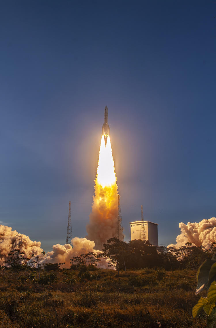
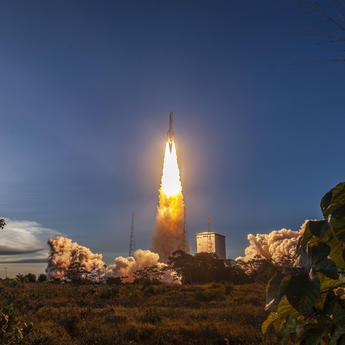
With the successful launch of the ESA Sentinel-1D satellite, the Airbus-built Synthetic Aperture Radar (SAR) onboard joins its siblings Sentinel-1A and Sentinel-1C, guaranteeing radar acquisition and continuity worldwide with a planned lifetime of more than seven years in orbit. Sentinel-1A was already launched in 2014 and is at the end of its lifetime and Sentinel-1C was successfully launched last December 2024.
Deployed under the European Copernicus programme, Sentinel-1D will carry out monitoring activities of missions supporting global land masses, sea- and land-ice and the ocean together with emergency response.
SAR, cutting-edge technology for all-weather, round-the-clock imaging
Thanks to their unique physical properties, SAR instruments are an indispensable technology for Earth observation. They are capable of identifying changes on land, sea and ice. Indeed, while optical satellites measure reflected sunlight, radar satellites such as Sentinel-1 actively transmit and receive radio waves.
The advantage of radio waves is that they allow data to be captured regardless of external conditions: radar can see through clouds, fog, and rain, and can acquire images day or night, ensuring a continuous and reliable data flow.
SAR images are not simple photos: they identify changes in surface texture (rough water vs. calm water, bare soil vs. forest canopy) and penetrate vegetation. Even more uniquely, SAR is capable of monitoring subtle movements related to geohazards (volcanic uplift, ground deformation after earthquakes).

Design adapted for millimetre precision
To fulfill this highly precise and diverse mission, Airbus teams in Friedrichshafen developed and tested an extraordinary, 12-metre long antenna with the antenna’s ‘brain’, the electronic subsystem developed by Airbus teams in Portsmouth. “This antenna design was necessary to achieve the required resolution and coverage for the SAR instrument,” explains Marcus Glatt, Airbus Sentinel-1 SAR Instrument Project Manager, “but developing an instrument of this length is not trivial.”
The radar's performance relies directly on the size of its antenna: the larger it is, the better the quantity and quality of the data collected. One major technical challenge is to guarantee perfect synchronisation: the radio frequency (RF) signal must be distributed and transmitted to Earth by the antenna's 280 transmit and receive modules at exactly the same moment, Glatt explains. “The slightest time delay across this 12-metre structure would affect the signal’s phase, which would directly compromise measurement precision, particularly for interferometry.”
To solve structural challenges related to the 12-metre length, the Airbus teams improved the existing waveguide radiator technology, a speciality developed in Friedrichshafen and used on other radar instruments. “This structure combines radiation, signal distribution and mechanical stiffness in a single lightweight component, ensuring optimal RF performance across the antenna,” says Glatt.
Folding 12 metres into three parts
The deployment of a 12-metre structure in space is one of the most critical phases. The antenna cannot be loaded onto the rocket in its deployed position due to the dimension of the fairing. An ingenious solution was necessary to fold it and then unfold it in orbit, while guaranteeing its perfect alignment. A single millimetre of difference in alignment makes a real difference for the transmission and reception of waves, which could affect the quality of SAR images.
Testing such a delicate and large structure under the influence of Earth's gravity is a real challenge for engineers who developed a special ‘off-loading’ device. If it were deployed on Earth without this, its own weight would cause it to sag, making the test unrepresentative of orbital conditions. “Right from the initial design phase for the first SAR instrument (Sentinel-1A) we carried out long test phases in our cleanrooms, to verify the proper functioning of the deployment mechanisms (hinges, latches, motors) and also the perfect planarity (flatness) with laser systems, to check that the shape does not show excessive curvature or torsion,” says Glatt.
Airbus also designed for Sentinel-1C&D the antenna with special joints that melt when exposed to intense heat, separating the radar antenna from the satellite platform during atmospheric re-entry. This new, patented technology allows for rapid and total disintegration at the end of the mission, contributing to safely reducing space debris.

A four-in-one instrument
The Sentinel-1 radar is designed to adapt to its mission using four different acquisition modes, similar to a camera's shot settings.
The Interferometric Wide Swath (IW) mode is the default setting over landmasses. Its wide coverage (250 km) is used for agriculture, identifying floods, and accurately measuring ground movement. The Extra-Wide Swath (EW) mode is used for oceans and coastal zones: its very wide swath width (400 km) is ideal for locating ships, oil spills, and monitoring Arctic ice. The two other settings are the Wave Mode (WV), which takes small ‘snapshots’ of the ocean to measure wave size and direction, and the StripMap (SM) mode to zoom in on very small areas (islands or emergencies) requiring a high level of detail.

Sentinel-1 has been designed and built by a consortium of around 60 companies led by Thales Alenia Space
Essential applications for societal Impact
Sentinel-1 delivers radar images for a wide range of applications such as monitoring land (forests, agricultural fields) and geological risks, maritime and polar surveillance, and in the event of natural disasters (floods, earthquakes, volcanic eruptions, and landslides).
Maritime surveillance
The enormous container ship Ever Given ran aground in Egypt's Suez Canal on 23 March 2021. The image on the right, captured on 25 March, shows the 400-metre ship blocking the canal entirely, contrasting with routine traffic on 21 March (image on the left).

(copyright ESA)
Oil slick detection and monitoring
Oil detection applications are essential for gathering evidence of illegal discharges, analysing the spread of oil spills, and prospecting for oil reserves. The Sentinel-1 image showed the scale of an oil spill off the coast of Trinidad and Tobago, moving over 160 km westward in February 2024.

(copyright ESA)
Agriculture
Monitoring crop conditions, soil properties and mapping tillage activities help assess land use, predict harvests, and monitor seasonal changes. A multi-temporal image of rice fields in the Mekong Delta (2020) combines three radar acquisitions taken a few weeks apart, highlighting precise changes in crop growth over time. Thanks to its ability to detect waterlogged soil, Sentinel-1 can monitor the entire rice cultivation cycle.

(copyright ESA)
Natural disasters
Sentinel-1’s radar can be used to assess the extent of flooding and its human and economic impact. Sentinel-1 data is widely used by the Copernicus Emergency Management Service (CEMS), providing critical data to support response efforts.
In October 2024, after torrential rains struck Valencia, Spain, the radar image below, using two acquisitions (October 19 and 31), illustrated the severity of the floods in the Albufera National Park.

(copyright ESA)
Analysis of earthquake consequences
The geological implications of a major earthquake can have long-term consequences, such as ground subsidence or landslides. Researchers use the technique of interferometry to compare ‘before and after’ views of an earthquake. This acquisition mode allows the production of deformation maps and the quantification of surface displacement.
The interferogram of acquisitions before and after the Turkish earthquake revealed the changes on the ground. According to experts, the interferogram indicates that the East Anatolian Fault ruptured during the first earthquake, showing up to several meters of fault slip at the Earth's surface.

(copyright ESA)
With Sentinel-1D entering service, the Airbus radar vision for Copernicus is ensuring Europe retains a critical monitoring tool for the protection of its citizens and environment.
Download
Infographic
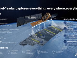
Infographic Launch Sentinel-1D
Infographic

Infographic Launch Sentinel-1D
The latest Space news
In the spotlight

Airbus and Hisdesat sign a commercialisation agreement for PAZ-2 satellite imagery
Press Release
Space
Airbus Defence and Space and Hisdesat sign a commercialisation agreement for PAZ-2 radar satellite imagery and applications
The first Airbus Pléiades Neo Next satellite will be launched early 2028
Press Release
Space
Airbus launches demonstrator to test global 5G connectivity in orbit
Press Release
Innovation
Airbus ships fourth European Service Module for Artemis IV
Press Release
Space
Sentinel-1D: the radar that never sleeps
Web Story
Space
