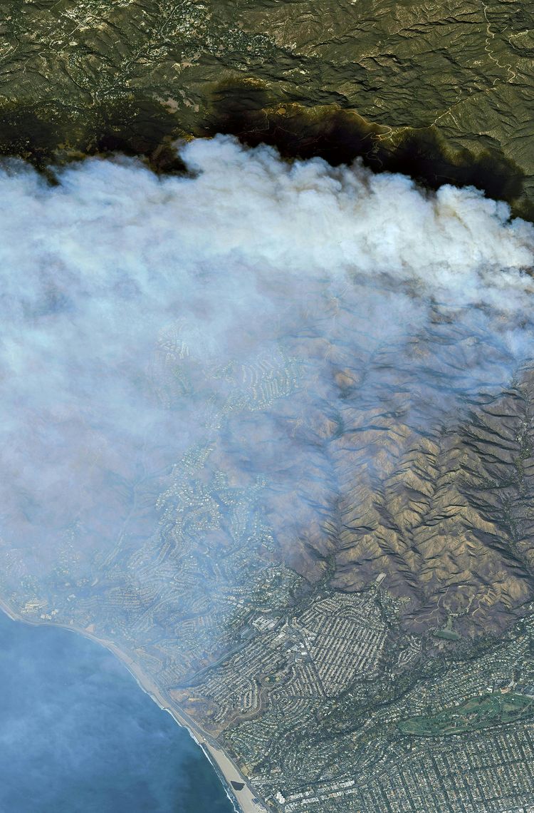
Air quality is a critical concern in society. The year 2025 marks a pivotal moment in monitoring the air we breathe with the launch of new European space capabilities, including advanced Copernicus Sentinels and EUMETSAT's next generation of weather satellites, such as the Airbus-built MetOp-SG A. These new missions are set to increase data collection and significantly enhance air quality forecasts.
Understanding air quality
Every day, humans inhale 14kg of air, taking in essential oxygen alongside trace amounts of gases and microscopic particles. These harmful constituents can directly affect health and impact ecosystems, not only during acute pollution events but also through chronic exposure. According to the World Health Organization, air pollution is responsible for nearly 600,000 premature deaths each year in Europe, and approximately seven million globally.
Air pollution primarily originates from the burning of fossil fuels, road traffic, and industrial emissions.
Its severity is often exacerbated by temperature inversions, which trap pollutants close to the ground, particularly during winter. Natural factors, such as Saharan dust storms and wildfires, also significantly degrade air quality.
More than just a measure of household and ambient pollution, air quality is a vital indicator for our overall health. This underscores the critical importance of identifying and tracking these harmful particles and gases.
Challenges of air quality monitoring
Mélanie Ades, an expert in data assimilation at the European Centre for Medium-Range Weather Forecasts (ECMWF), explains the complexities: “Monitoring air quality is a real challenge. Pollutants can be rapidly transformed by chemical reactions and transported by wind, making it difficult to understand how pollution fluctuates throughout the day. Moreover, accurate forecasts require not only observations but also robust predictive capabilities".
Alongside other scientists she works as part of the Copernicus Atmosphere Monitoring Service (CAMS), which uses state-of-the-art modelling systems to transform satellite observations into useful and free-to-use information for policymakers, environmental agencies and citizens around the world, enabling rapid action.
“To produce air quality forecasts, we rely on prediction models that understand how chemicals react, how winds carry pollutants and how other parameters like sunlight or temperature influence air quality. These models are the core of our forecasts. But to ensure they closely reflect reality, we constantly adjust them through a procedure called ‘data assimilation’. Every twelve hours we incorporate real-time measurements, comparing them with previous model forecasts. The model state is then updated and a new forecast is initiated. By constantly updating predictions with real-time data, we can provide a reliable picture of the air we breathe and make forecasts for up to five days,” says Ades.
Space-based data for air quality forecasts
CAMS currently leverages observational data from various Copernicus satellites. Sentinel-5P, designed and built by Airbus, provides observations of ozone, nitrogen dioxide, carbon monoxide and sulphur dioxide while Sentinel-3 provides observations of aerosol optical depth, which can be used to track the pollutants emitted from fires. Observations of active vegetation fires around the world from Sentinel-3 will also eventually be used in CAMS to estimate biomass burning emissions.
In May and June 2025, Canada experienced intense forest fires. CAMS effectively tracked and forecast the smoke plumes as they spread across the Atlantic, reaching Europe and coinciding with the transport of Saharan dust on 13 June.
Canadian Wildfires Update 13.06.2025
Copernicus Atmosphere aerosol optical depth forecast initialised on 11 June showed a complex mixture of aerosols over Europe in recent days with smoke transport from Canadian wildfires interspersed with a plume of Saharan dust.
Copyright: CAMS
CAMS also reported an episode of high ground-level ozone concentrations across Europe in June 2025. Ground-level ozone is a major air pollutant, particularly on sunny days. It forms through chemical reactions between nitrogen oxides (NOx) and volatile organic compounds (VOCs) – gases emitted from cars, industries, and other sources – in the presence of sunlight. Unlike beneficial ozone in the upper atmosphere, ground-level ozone can damage human respiratory systems and vegetation.
CAMS surface ozone concentrations analysis
CAMS regional ensemble hourly analysis of surface ozone concentrations between 9 June and 21 June 2025, showing the diurnal cycle of tropospheric ozone.
Copyright: CAMS
Next generation of satellites to enhance capabilities
Launched in July 2025, the Airbus-built Sentinel-4 instrument on the third generation Meteosat (MTG-S1) satellite will be integrated into CAMS models. It will provide unprecedented hourly high-resolution data on atmospheric pollutants (ozone, nitrogen dioxide, sulphur dioxide and aerosols) over Europe. This will enhance Copernicus’ monitoring capabilities, moving from one image of Europe per day with Sentinel-5P to hourly observations. “With this new instrument, we will be able to model the diurnal cycle of some pollutants and update our models more frequently,” says Ades.
European space-based capabilities will be further augmented by MetOp-SG A and its six instruments. The Airbus-built Infrared Atmospheric Sounding Interferometer (IASI-NG) is capable of monitoring ammonia which impacts air quality. While its onboard Sentinel-5 spectrometer, operated by EUMETSAT, will complement Sentinel-4. It can differentiate between 1,000 more colours than the human eye, detecting and measuring a host of trace gases, as well as aerosols and the UV index, on a daily basis.

| 
|
Caption: Air monitoring Sentinel-4 and Sentinel-5 instruments
Enabling research and applications
The rich data from satellite observations and air quality forecasts are indispensable tools. They enable governments to alert the population when pollution levels exceed regulatory limits, to assist policymakers in developing effective air quality strategies and support scientists in refining climate models.
“CAMS analyses and forecasts can also be used directly by citizens or through smartphone applications such as Windy, which allows users to visualise air quality data for major air pollutants such as nitrogen dioxide and fine particulate matter,” explains Ades.
With their enhanced monitoring capabilities, more frequent updates and higher resolution data, the new generation of European satellites, equipped with their powerful instruments, represents an important leap, helping to deepen our understanding of atmospheric processes and to improve air quality forecasts.
