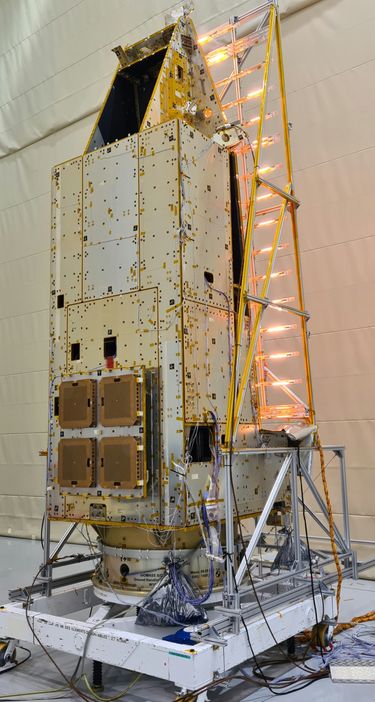
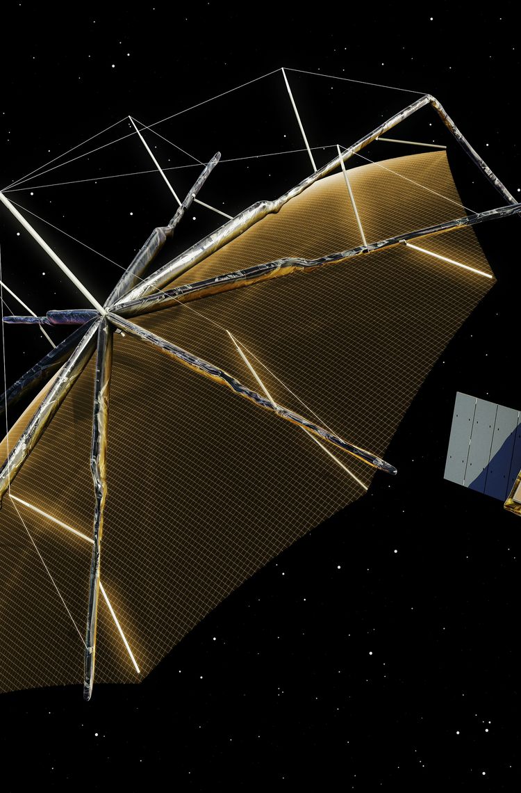
Forests, especially tropical rainforests, are guardians against climate change. But our forests are burning. They are withering and dwindling. Our guardians are themselves threatened by climate change. A new European Space Agency (ESA) satellite mission, currently being built by Airbus, is set to investigate exactly how our forests are faring. The name says it all: Biomass.
Our forests and global climate are closely linked. Forests are huge carbon stores. They cover around one third of the world’s surface, but they store about half of the carbon bound on Earth. With their needles and leaves, they filter the carbon dioxide in the air that is so harmful to the environment and split it into oxygen and carbon. They release vital oxygen back into the air and retain the carbon.
Forests also influence evaporation, water cycles and thus the weather. Interconnected forest areas function like huge air-conditioning systems. Tropical forests also have a cooling effect on the climate. However, if temperatures rise worldwide, tropical forests may dry out and die. If the forests die, the carbon stored in them is released and their important climate-regulating and cooling function is lost.
Carbon is stored in many different types of forests, such as boreal forests, tropical rainforests, mangroves, urban forests and plantations. These forests differ in their ability to store carbon and produce biomass. But experts estimate that up to 75 % of the world's biomass is found in forests. And the forests are shrinking. On an unimaginable scale: since 2010, 11 million hectares per year, or the equivalent of roughly 30 football fields per minute!

ESA's Biomass environment and climate mission will therefore monitor tropical rainforests. Its main scientific objectives include determining the distribution of above-ground biomass in the rainforests and measuring the annual changes in this mass.
Biomass and vegetation height are recorded at a resolution of 200 metres, intrusions in the forest system, such as clear-cutting, at a resolution of 50 metres. The spacecraft will carry the first space-borne P-band radar to deliver exceptionally accurate maps of tropical, temperate and boreal forest biomass that cannot be obtained on the ground. Biomass will achieve this using a ‘synthetic aperture radar’ to send down signals from orbit and record the resulting backscatter, building up maps of tree height and volume. To see through leafy treetops to the trees themselves, Biomass will employ long-wavelength ‘P-band’ radar, which has never previously flown in space. It will have its signals amplified to travel down from a 600-km altitude orbit down to Earth and back.
The mission will collect frequent information on global forests to determine the distribution of their above-ground biomass and measure annual changes. This unique satellite will provide a full global map of forest biomass stocks at a spatial resolution in the order of 4 ha, once every year over the life of the five-year mission, providing an entirely new dataset for climatologists to work with.
These maps will greatly improve on existing forest inventories and give vastly improved information for managing Earth’s forest resources. The data collected by Biomass will also capture subsurface geological structures in desert areas and the topography of surfaces hidden under dense vegetation. Observations from this new mission will also lead to better insight into rates of habitat loss and, therefore, the effect this may have on biodiversity in the forest environment.
Famous author Ernest Hemingway said: “Earth is a fine place and worth fighting for.” So let’s get Biomass into orbit to monitor it, learn about it and – fight for it.
