Helping monitor climate change
From Brazil to Central and West Africa, countries are relying on satellite imaging to set up their reforestation initiatives and conservation strategies
Forests as climate stabilisers
The battle against global warming is being fought in the world’s largest forests through the use of highly accurate satellite imagery.
Airbus Defence and Space satellite constellations are helping to create breathing room for Earth’s lungs by providing data for forest monitoring and management across the world, from Central and West Africa to Brazil and Southeast Asia.
Thirty percent of the Earth’s land surface is covered by forest, which acts as a crucial climate stabiliser.
When forests are cleared, cut or burned, stored carbon is released into the atmosphere in the form of carbon dioxide and methane.
20% of global greenhouse gas emissions and nearly 30% of CO2 emissions are caused by deforestation and forest degradation, according to the UN’s REDD Programme and Food and Agriculture Organization (FAO). This is more than the world’s entire transport sector and second only to the global energy sector.

A threat to biodiversity
The Congo Basin’s jungles are the world’s second-largest tropical forest cover, extending across 300 million hectares.
Aside from its contribution to global warming, deforestation in the Congo Basin and other regions also leads to soil desertification, droughts, loss of biodiversity and social deprivation for the 1.6 billion people worldwide who rely on forest resources for their livelihoods.
SPOT–light on Central and West Africa
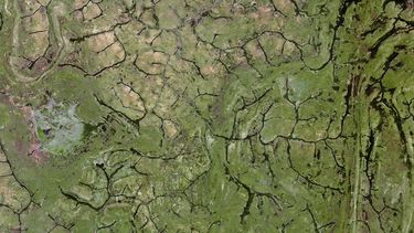
Through a programme with the French Development Agency (AFD), Airbus Defence and Space has been providing SPOT satellite images to national agencies in five countries in the Congo Basin for the last five years: Cameroon, Central African Republic, the Republic of the Congo, the Democratic Republic of the Congo and Gabon.
“It’s an open licence approach for those involved in the sustainable management of forests and development of responsible agro-industries,” says Patrick Houdry, in charge of intelligence activities for forest and environment markets at Airbus DS. “Local actors like NGOs can better analyse forest preservation, for example, and have precise information on what the local drivers of deforestation are.”
Better carbon emissions tracking
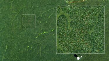
From March 2016, a new project known as OSFACO (Space-Based Observation of the Forests of Central and West Africa), supported by the AFD, is extending its coverage to Guinea, Benin and the Ivory Coast, supplying satellite imagery with a resolution of up to 1.5 metres. These images allow for a thorough survey of forest cover and land use over large expanses that are otherwise difficult to access and monitor.
Together with providing the images, Airbus DS focuses on capacity-building initiatives and the training of local geo-information experts. “Instead of telling them what to do,” says Houdry, “we want them to have autonomy, to become the protagonists of their own development.”
The programme has also provided participants with forest maps and REDD+ baselines from 1990–2010, which will help them access funds from the United Nations’ REDD/REDD+ deforestation programmes.
This information also helps countries make political decisions, balancing deforestation reduction and pushing agricultural development forward.
Biomass: ESA’s forest mission
One of the latest developments in the Earth Observation field will be the construction of Biomass, a new European Space Agency satellite. Biomass will deploy the first P-band radar antenna in space, helping to deliver land usage and global forest cover information with unprecedented accuracy.
From 2010–2015, SPOT satellites delivered coverage of almost 3 million square kilometres in the Congo Basin and contributed to the mapping of African forests, including historical analysis of deforestation over the past 15 years.
UN REDD: Guardians of climate change
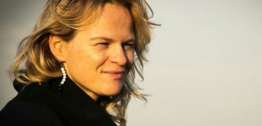
The United Nations has two global programmes to fight deforestation in developing countries called REDD/REDD+. The project’s technical staff, Inge Jonckheere and Erik Lindquist, explain how it works.
How has satellite imaging helped to develop REDD/REDD+?
Inge Jonckheere: In order to reduce emissions, national authorities need a good view of the problem. But many countries, for example, those in the Congo Basin, did not have historical data or a forest inventory. Often, the only way you can get a national inventory here is through satellite data. Thanks to the images and the recent decision to make historical archives freely available, we know what is happening in each country in a transparent way.
How has the Congo Basin Project worked out?
Erik Lindquist: We are talking about the second largest tropical forest outside the Amazon. While Brazil has a more mature tracking system, for geopolitical reasons, the Congo Basin countries, for geopolitical reasons, have not been as well-recorded. This is an area where the world is focusing because it is very valuable for the whole Earth system. Thanks to the help of data providers like Airbus, we were able to set the capacities needed, build trust relationships and educate local technicians. It is great news that the original project is being renewed for three more years.
What are the new goals being pursued by the project?
I.J: The new phase is focusing on forest degradation. Lots of countries wanted to participate in REDD but they couldn’t, due to low deforestation rates. In those countries, forest degradation was the issue, and now REDD+ is focusing on this other aspect. Satellite imaging will remain crucial in this task. E. L: We know more than we have ever known about how the planet is changing, and we owe the data providers for that. We trust that they’ll continue their contribution, helping the international community and national governments make the right decisions to combat climate change.
The many faces of deforestation
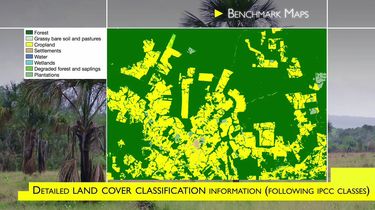
Preserving the world’s forests is not only about fighting deforestation but also battling illegal crops, degradation and desertification. Airbus DS FOREST is a game-changing tool for countries that want a detailed picture of the problem.
7 million hectares of forest disappear every year, according to the Food and Agriculture Organization of the United Nations
One tool to fight global warming
Many countries lack the resources to track changes in vegetation cover or even know their historical record. Moreover, positive outcomes of COP21, new entrants in the REDD+ market and new challenges faced by some countries demand higher quality mapping and monitoring tools.
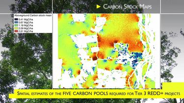
Combining vegetation models and satellite imagery, Airbus DS FOREST (Fully Optimized and Reliable EmissionS Tool) helps track tree cover over large swaths of land and even determine how much carbon dioxide is stored within specific areas. This, in turn, helps countries participate in the global carbon emissions trade system.
FOREST is designed to make a positive impact on climate change. The joint effort incorporates Airbus Defence and Space optical (SPOT, Pleiades constellations) and radar (TanDEM-X, TerraSAR-X) data, as well as integrating Sentinel 2 and free images from other satellites. This imagery is combined with the expertise of several research institutes and private companies specialised in forestry, CO2 emission calculations and climate solutions.
"I’m very happy to see how our services are used directly on the ground; basically every country that has a tropical forest has shown interest."
Alexandra Nouillas
FOREST project manager
A more powerful 'detective' for illegal logging
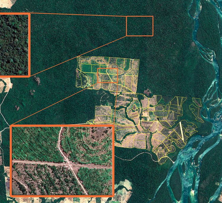
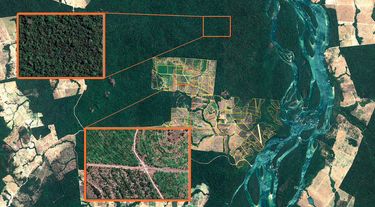
FOREST helps reveal illegal logging and illicit crops that are otherwise very hard to spot.
Pierre Duquesne, Intelligence expert at Airbus DS Brazil, explains how satellite imagery is already making a difference here. “Previously, huge expanses of trees were cut, but over the years the patterns of illegal deforestation have changed because loggers are increasingly being spotted by satellites. Now they tend to log smaller patches so the deforestation is not detectable from space.
Airbus Defence and Space DMC satellites have a higher resolution and are used by the INPE Brazilian Space Research Institute to detect even these minor-scale activities.”
Loggers in Brazil are now also operating during the rainy season so that clouds may shroud their activities. This explains why Brazilian authorities are evaluating Airbus DS Terrasar-X radar images, which penetrate the clouds and can detect changes in the canopy
Sustainable development for tropical forest
With the commercialisation phase kicking off in September 2016, FOREST end users will include institutions that enforce forestry management policies, private companies that conduct impact studies of their activities, countries that implement international programmes like the UN’s REDD+ and investors in carbon-based trading.
“We already have success stories,” says Alexandra Nouillas, FOREST project manager. “We have fine-tuned the tool with demonstration workshops and trainings in several thematic applications in Cameroon, Brazil and Peru.”
Authors: Nuño Domínguez / Álvaro Friera
FOREST: an ally for preservation
The user-oriented FOREST provides on-demand solutions like forestry maps, carbon stock estimations, land-cover change detection and analysis to a wide range of decision-makers.
