Airbus provides a new look at the world
With some 60 Earth observation satellite launched since 1986, Airbus is a supplier of choice for European institutions and customers around the world. The spacecraft have demonstrated an excellent level of mission success: many remain in orbit well beyond their originally scheduled lifetimes.
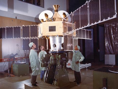
Among the cornerstone Earth observation missions is Meteosat, the first European weather satellite and the basis for Airbus’ competence in meteorological platforms. Built by an industrial consortium, the prototype Meteosat-1 was launched in 1977 on a U.S. Delta rocket, followed by six others that were orbited by Ariane launchers beginning in 1981.
Meteosat’s origins came from the European Space Research Organisation (the European Space Agency today) – which funded studies of application satellites, with Meteosat introducing a global system of geostationary platforms capable of observing the atmospheric circulation and weather around the equator in near real-time. In September 1972, ESRO officially adopted the Meteosat programme and the first prototype Meteosat was launched in November 1977, followed by launches of Meteosat-2 through Meteosat-7 between 1981 and 1997. To ensure the long-term continuity of Meteosat, a convention for the EUMETSAT organisation was agreed in 1983 – creating a specialised operational agency for management of the meteorological satellites and their data.
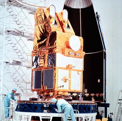
The spin-stabilised Meteosat satellites had a liftoff mass of approximately 280 kg. and operated from a geostationary orbit of 36,000 km., sending detailed images back to Earth every 30 minutes. In addition to providing information on cloud cover and weather fronts, infrared imagery from the spacecraft tracked temperatures and the distribution of water vapour in the atmosphere – giving meteorologists a global 3D image of the planet’s weather patterns.
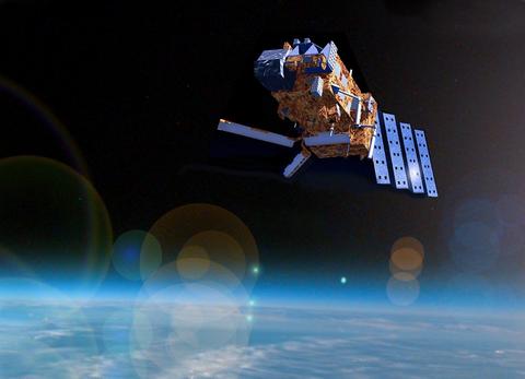
MetOp satellite
From Meteosat to ERS and MetOp
The European Remote Sensing satellite (ERS) was the European Space Agency's first Earth-observing satellite programme in a polar orbit, developed by Airbus predecessor companies Dornier (as prime contractor) and Matra (for the spacecraft bus). With launches on Ariane vehicles from French Guiana in July 1991 and April 1995, these three-axis-stabilised satellites were the most sophisticated Earth observation platforms spacecraft developed and launched by Europe at the time.
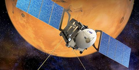
ERS satellites carried a Synthetic Aperture Radar (SAR) – a high-resolution, wide-swath imaging radar providing high-quality images of the oceans, coastal zones, polar ice and land regions in all weather conditions, day or night. Europe’s next step was the MetOp (Meteorological Operational satellite) programme, for which Airbus is prime contractor and provides instruments. It comprises three polar-orbiting spacecraft that circle the Earth at an altitude of 830 km. and complete an orbit around the globe in some 100 minutes.
As their orbits are 42-times closer to Earth than the Meteosat geostationary satellites, observation data provided by MetOp platforms are much more detailed, enabling more precise weather forecasting, better prediction of natural disasters, and enhanced measurements for issues such as climate change, the progressive melting of polar ice and the rise in sea levels. The three-axis-stabilised MetOp spacecraft, weighing in the 4,000 kg.-class at liftoff, were developed in a joint undertaking between the European Space Agency (ESA) and EUMETSAT, carrying 10 to 12 instruments.
Metop-A was launched in October 2006 on a Soyuz rocket from Baikonur Cosmodrome, followed the orbiting of Metop-B in September 2012 (on Soyuz from Baikonur Cosmodrome) and Metop-C in November 2018 (with Soyuz from French Guiana) – creating the space segment component for the overall EUMETSAT Polar System (EPS).
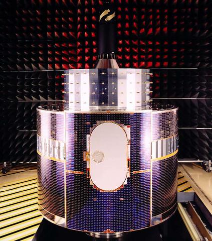
Meteosat satellite. Photo: ESA
Coverage with MetOp-SG and Sentinel
In October 2014, Airbus was selected to design and build the second-generation MetOp satellites (MetOp-SG), which consist of two satellite types: Series A and B, with three units in each series. To be launched from 2024, MetOp-SG programme will further improve weather forecasting and climate research. The MetOp-SG’s Satellite A series is to incorporate optical instruments and atmospheric sounders (with a liftoff mass of approximately 4,000 kg.), while the Satellite B series will carry microwave instruments, having an estimated liftoff mass of 3,818 kg. Europe’s most ambitious Earth observation programme to date is called Copernicus (previously known as GMES for Global Monitoring for Environment and Security). Headed by the European Commission in partnership with the European Space Agency, it is designed to provide important information in six key areas: land monitoring; marine environment monitoring; disaster and crisis management; monitoring the Earth’s atmosphere; climate change monitoring; and security. Airbus is playing a crucial role in constructing the programme’s satellites as well as their instruments.
The first generation of this family of satellites is called the Sentinels and Airbus’ responsibilities for the Sentinel spacecraft include: developing and building the radar instrument for Sentinel-1; prime contractor for Sentinel-2 and supplying a spectral mode observation instrument; designing and building the microwave radiometer (MWR) for Sentinel-3; prime contractor for the two spectrometers on Sentinel-4; designing and building the satellite and instrument for the Sentinel-5 Precursor (5P); prime contractor for the Sentinel-5 imaging spectrometer; and prime contractor for Jason-CS/Sentinel-6.
Accurate and timely information supplied by the Copernicus effort began with the all-weather, day and night radar images from Sentinel-1A and Sentinel-1B, launched in April 2014 and April 2016, respectively. Sentinel-2A, launched in June 2015, delivers high-resolution optical images for land services, while Sentinel-2B was orbited in March 2017, joining its Sentinel-2A twin. A pair of Sentinel-3 satellites, launched in February 2016 and April 2018, provide data for services related to the ocean and land. Launched in October 2017, Sentinel-5 Precursor (Sentinel-5P) ensures the continuity of data to monitor the ozone hole and tropospheric pollution. Sentinel-6A, orbited in November 2020, carries out high-precision measurements of ocean surface topography. Sentinel satellites benefit from the SpaceDataHighway services provided by Airbus, with Sentinel-1 and Sentinel-2 equipped with laser communication terminals from an Airbus subsidiary that significantly accelerate the delivery of time-critical data and large volumes of data to Earth monitoring centres.
In 2020, ESA approved six additional missions to expand the capabilities of the Copernicus programme. Airbus has a key role in three of these missions. The two Airbus-built CRISTAL spacecraft will monitor sea-ice thickness and overlying snow depth using dual-frequency radar altimeter and microwave radiometer technology from Airbus. The data will support maritime operations in polar oceans and contribute to a better understanding of climate processes. CRISTAL will also support applications related to coastal and inland waters and the observation of ocean topography. The LSTM mission will help farmers achieve sustainable agricultural production at field-scale in a world of increasing water scarcity. The two satellites will be able to identify the temperatures of individual fields and image the Earth every three days at 50 m resolution. This is about 400 times more detail than is currently acquired from space. Airbus is prime contractor for this next generation satellite, including its high spatial-temporal resolution thermal infrared sensor.
Since longer L-band signals can penetrate through many natural materials – such as vegetation, dry snow and ice – the ROSE-L mission will complement the information gathered by the Copernicus Sentinel-1 C-band radar mission – supporting forest
management, precision farming and food security and ocean monitoring. The radar antenna will be the largest planar antenna ever built measuring an impressive 11 metres by 3.6 metres.
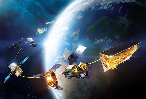
Airbus Sentinels
Putting Earth “on the SPOT”
The SPOT series of polar-orbiting satellites trace their roots to Airbus predecessor company Matra, setting new standards for commercial high-resolution optical imaging of the Earth. Incorporating improved features over the years, the SPOT spacecraft series were launched beginning in February 1986 (with SPOT 1) through June 2014 (SPOT 7). The SPOT system includes a series of satellites and ground resources for satellite control and programming, image production, and distribution – all with Airbus support. With SPOT 6 and SPOT 7, Airbus ensured mission continuity of its SPOT series – which has collected more than 30 million Earth scenes since 1986.
The “twin” SPOT 6 and SPOT 7 satellites incorporated technological improvements and advanced system performance, increasing reactivity and acquisition capacity, as well as simplifying data access. SPOT 6 and SPOT 7 operate in the same orbit with the very-high-resolution Pléiades 1A and Pléiades 1B spacecraft as a four-satellite constellation, providing an optimum combination of detail and broad coverage.
The programme for Pléiades 1A and Pléiades 1B was initiated in October 2003 with the CNES French space agency as overall system prime contractor and Airbus predecessor EADS Astrium as the prime contractor for the space segment – providing its first commercially-available sub-meter resolution satellite. The Pléiades satellites were orbited in December 2011 and December 2012, with both spacecraft launched by Soyuz rockets from French Guiana.
In September 2016, Airbus announced the creation of its own very high resolution optical constellation. With four identical satellites, Pléiades Neo offers intraday revisit capacity of any point on Earth, improved reactivity in satellite tasking, and the ability to capture millions of km² per day at 30 cm native resolution. The first satellite was launched from French Guiana in April 2021, closely followed by the second one in August. The last two satellites will be launched together in 2022.
Expertise for international cooperation
Airbus’ Earth observation satellite expertise for Europe makes the company a preferred supplier for an increasing number of international customers. An example is the Vietnamese VNREDSat-1 programme, awarded in 2010, for Airbus’ development of a system comprising an optical satellite capable of capturing images with a resolution of 2.5 metres and the associated ground control, image receiving and processing stations. The objective was to create a space system enabling Vietnam to better monitor and study the effects of climate change, predict and take measures to prevent natural disasters, and to optimise the management of its natural resources.
Designed and developed by Airbus in partnership with the French CNES space agency, the 150-kg. satellite was placed a Sun-synchronous orbit in May 2013 by a Vega launcher from French Guiana. KazEOSat -1 and KazEOSat-2 are the first Earth observation satellites for Kazakhstan. Built by Airbus, KazEOSat-1 was launched into Sun-synchronous orbit in April 2014 from French Guiana on a Vega launch vehicle for operation by Kazakhstan Gharysh Sapary – a division of Kazcosmos. Based on Airbus’ AstroBus-L platform, the 830-kg. high-resolution KazEOSat-1 provides a complete range of civil applications in Kazakhstan, such as monitoring natural and agricultural resources, the gathering of mapping data and providing support for rescue operations in the event of natural disasters.
As a follow-on, the medium-resolution KazEOSat-2 was built by SSTL (the British subsidiary of Airbus) and orbited as a 177-kg. payload in June 2014 on a Dnepr launcher from Dombrowski in Russia. PerúSAT-1 is a 430-kg. satellite produced by Airbus in record-time as the sole prime contractor to the Peruvian Space Agency, CONIDA. The programme’s rapid pace was made possible by the creation of the “Projects Factory©,” a new and more integrated working organisation in Airbus’ Space System business unit, which brought down development and construction lead times for satellites weighing to 500 kg. while optimising their costs and schedule delivery – all without impacting quality. PerúSAT-1 was placed in polar orbit by a Vega rocket launched from French Guiana in September 2016.
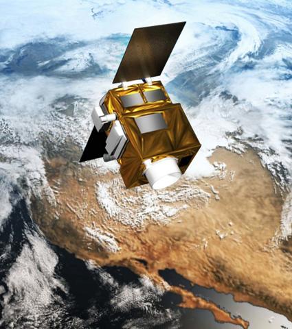
AstroBus-S
Tracking Earth’s water movement with GRACE
Launched in 2002, GRACE (Gravity Recovery and Climate Experiment) was a joint U.S. NASA/German DLR mission with a primary objective to measure Earth's gravity field and its time variability with unprecedented accuracy.
The secondary goal was to obtain approximately 150 very precise globally-distributed vertical temperature and humidity profiles of the atmosphere per day using a GPS occultation technique.
The GRACE mission ended in 2017, having lasted three-times longer than originally planned. GRACE was succeeded by the 2018 launch of GRACE-FO (GRACE Follow-On), which uses near-identical hardware.
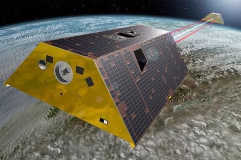
GRACE-FO

