DeckFinder™ is a local positioning system that lets manned and remotely piloted aerial vehicles (RPAS) determine their relative position in the harshest environmental conditions. The independent navigation system contributes to easier and safer take-off and landing procedures in GPS-shaded environments that lack reference points or visual cues.
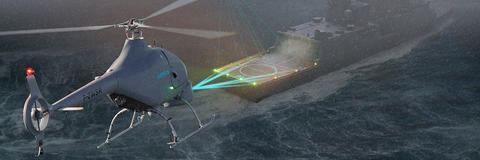
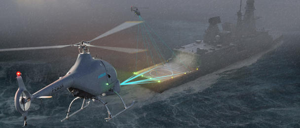
When landing on small or moving helidecks, a difference of a few centimeters can compromise and endanger a whole mission. To avoid such risk, DeckFinder™ provides a 3-dimensional image of the RPASs relative position, aiding in landing the aerial vehicle safely.
DeckFinder™
- Ad-hoc temporary or permanent installation
- Line and/or battery powered
- Rugged system components to withstand harsh environmental and operational conditions
- Operational temperature range from -32°C to +55°C
- Lightweight components
- Standardised interface to connect to downstream resources
Product overview
DeckFinder™ is a high-end positioning sensor that supports naval operations by ensuring an elevated degree of positioning accuracy of more than 20 cm, especially during take-offs and landings. The system can handle dynamic situations with an update rate of 33 Hz and a scalable operation area up to 300 metres. Its components are designed to perform optimally in harsh conditions: the rugged Ground Station Units are built to withstand extreme temperatures ranging from -32°C to +55°C, and the 1.6 kg airborne equipment can operate in salt water environments.
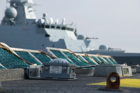
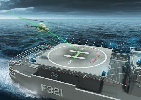
DeckFinder’s three segments work in triangulation. The Ground Segment includes the components installed on the landing spot, an Airborne Segment corresponds to components on the aerial vehicle itself, and a Monitoring and Software Control Segment consists of management software that updates the vehicle’s position on a flight display or the data interface. DeckFinder™ ground stations can be installed on any fixed or moving ground base.
DeckFinder™ works with multilateral, independent RF-based ranging signals. Distance measurements are done on a proprietary measurement principle in a license-free RF band that is independent from the Global Navigation Satellite System (GNSS). This innovative technique serves to determine the range between the ground station antennae and the airborne segment antennae with a high degree of accuracy in a local area.
Concept overview
Ground segment
The Ground Segment uses six ground units (GSU), placed on the landing pad according to a predefined geometry, to calculate the distance of the airborne vehicle from the ground.
The GSU antennae emit RF-based ranging signals that, once received by the Airborne
Segment, are used to determine the RPAS’s relative 3D position to the Ground Segment.
Airborne segment
Three airborne units calculate the distance of the airborne vehicle from the ground. The Range Measurement Unit (RMU) is connected to two antennae positioned at the front and back of the airborne vehicle and oriented downwards. A Positioning Calculation Unit (PCU) is connected to the RMU and an optional Altimeter via two serial interfaces.
Monitoring and software control segment
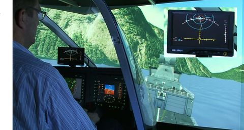
Installed on a host computer connected to one of the GSUs via Ethernet, the control segment software allows an operator to visualise the 3D position of the RPAS. For manned helicopters, the visualisation is also possible on head-mounted displays or fused into existing multi-functional displays (MFD) inside the aerial vehicle. The user interface is composed of a crosshair section, a height section, and a telemetry section.
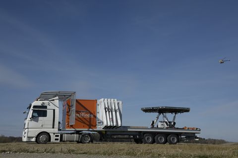
Missions
DeckFinder™ enables fully automatic helicopter take-offs and landings, as well as for both manned and unmanned aerial vehicles, and is operative on stationary and dynamic surfaces.
DeckFinder’s standardised data interfaces enable it to connect with most autopilot systems in manned and unmanned helicopters, allowing the autopilot to perform an exact landing in difficult situations such as on moving ship decks, trucks, as well as in GPS-shaded or reduced visibility environments. In addition, thanks to its standardised data interfaces, DeckFinder™ can adapt to customer requirements.
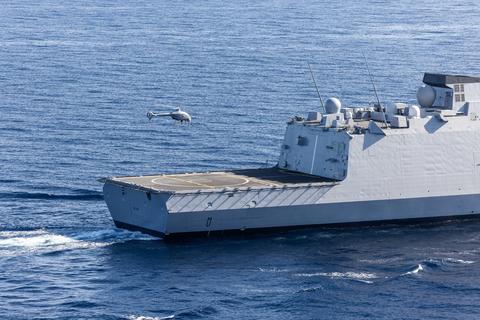
Landing on moving surfaces
DeckFinder™ excels at aiding rotorcraft landings on moving ship decks, as during offshore operations. For landings involving a pitching and rolling ship deck, DeckFinder’s system of reference points integrated on the ship deck itself provides a crucial advantage to safe navigation.
The same principle can be used for landing a RPAS on moving trucks, as during military operations or convoy surveillance missions in areas where GPS may be jammed and vehicles’ safety depends on staying in motion.
GPS-shaded and reduced visibility enviroments
GPS-shaded environments affect aerial vehicles mainly near offshore platforms, and in urban and mountain areas, with the result that the autopilot’s efficiency is limited. In these situations, DeckFinder™ provides crucial landing assistance.
Another variant of visibility is weather. With its independent positioning assistance, DeckFinder™ overcomes GNSS performance, supporting landings even in extreme conditions such as thunderstorms, blizzards, or dense fog. Further, DeckFinder’s accurate measurements and rugged components operate just as efficiently in harsh environments with vibrations, salt water projections, dust or extreme temperatures.
Services
DeckFinder™ comes with service support during installation, operation and maintenance.
The service support includes:
- Simulation models and simulation support
- Integration and test support
- Planning and model design
- Installation and commissioning
- Operator and maintenance training
- Documentation (manuals, datasheets etc.)
